Highways of Colorado

A guide to the past, present and future of
highways in the Centennial State

Online since 1997


  Southbound US 285 in Monte Vista.


Official Colorado Traffic Info:
CoTrip.org
CoTrip.org
Real-time road/weather conditions,
lane closures, alerts, traffic cams, etc.

Quickie News Items (Updated approximately weekly or biweekly)

  • 26-Apr-08: No luck with US 36 funding. Earlier in the month CDOT reapplied for special federal funding to put in HOT/BRT lanes on US 36 to Boulder, but the USDOT has instead awarded money to Los Angeles. Posted 26-Apr
  • 25-Apr-08: CDOT raised the speed limit on I-25 in southeast Denver to more closely reflect vehicle speeds. Previously 55 mph north of Belleview, the limit has been raised to 65 mph north to Evans and 60 mph north to Logan, where it drops back to 55. Posted 26-Apr
  • 17-Apr-08: The Colorado Legislature has passed a resolution naming US 285 from the New Meixco border to C-470 as the Ralph Carr Memorial Highway. At its April meeting the Colorado Transportation Commission accepted the designation memorializing the WWII-era governor. Posted 18-Apr
  • 17-Apr-08: At its April meeting, the Colorado Transportation Commission pulled $1.6M out of CDOT's contingency fund for emergency pavement repairs on various highways across the Western Slope. The above-average winter snowfall has taken a heavy toll on pavement, in some places the speed limit has been reduced from 65 to 25 mph due to road damage. CDOT's contingency fund started at $57M at the start of the fiscal year, and is now down to a mere $10.8M due to various issues (heavy snowfall, I-25 sinkhole, I-70 Bennett bridge damage, etc.). Posted 18-Apr
  • 15-Apr-08: A vicious grass fire blew through Ordway. Along the way it burned the timber bridge that takes SH 96 over the Numa Drain Canal two miles west of town. In the thick smoke, motorists could not see the bridge was out, and two fire fighters rushing to the town in their rig plunged into the opening and died. (A really bad day: Another fire fighter died when his tanker plane crashed while fighting a wildfire on Fort Carson.) CDOT made emergency repairs by putting temporary culvert pipes at the crossing and reopened SH 96 on 17-Apr. Posted 18-Apr
  • 11-Apr-08: CDOT has begun a "Rail Relocation for Colorado's Communities" study. It builds on a 2005 study which found there would be substantial public benefit to relocating through freight-rail traffic out of the Front Range urban corridor and out onto the Eastern Plains. The new study is more detailed and will evaluate preliminary rail alignments, estimate costs, investigate sources of funding and determine next steps. Posted 11-Apr
  • 10-Apr-08: CDOT has bid out another phase of the south I-25 widening project. The $29.4M project will widen I-25 to six lanes through Castle Rock from Wolfensberger Road to Plum Creek Parkway, and rebuild the oddly-arranged Plum Creek interchange into a standard diamond shape. Posted 11-Apr
  • 8-Apr-08: In a letter to the US DOT, Gov. Ritter has renewed CDOT's bid for special federal funding for building stripe-separated HOT/BRT lanes on US 36 from Denver to Boulder. The federal Urban Partnership Agreement Program had originally pledged some money to New York for a NYC congestion pricing program, but recently the New York State Assembly killed the idea. With the withdrawl of New York from the list of funded projects, CDOT and the US 36 coalition hope to secure $234M to add the lanes and rebuild the necessary bridges. Posted 11-Apr
  • 4-Apr-08: CDOT released its snow removal costs for the '07-'08 winter season. The original budget was $43M, but through mid-March the department spent $53M and is expected to spend $71M by the end of the season. The contingency built into the snow budget has already been spent. Posted 4-Apr
  • 3-Apr-08: CDOT bid out two major projects. 1) The first, for $26.7M, will build the first part of the eventual US 160/550 interchange east of Durango. The project will construct ramps and an overpass east of the existing intersection, but will only serve local roads until a future project relocates US 550 to it. 2) The second project is a continuation of CDOT's US 287 concrete resurfacing. The $17.3M poject will reconstruct US 287, the Ports to Plains Corridor, in concrete from mileposts 60 to 73 (south of Lamar). Posted 4-Apr
  • CDOT press releasesRecent/Upcoming Projects Out to Bid
Phone info

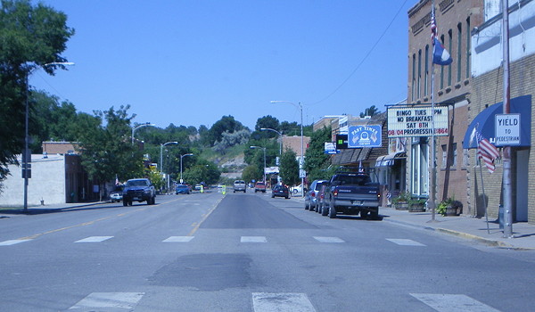
This site is meant to be a warehouse of information on the highways and byways and Colorado. The general idea is you can look at all the numbered state-maintained highways in the state, and learn useless, Trivial Pursuit stuff about them like where they end, how long they are, where they're freeway, etc. The site also includes writeups on major non-state roadways in Colorado, such as Peña Blvd. and the Pikes Peak Toll Road. Other pages include a history of roads in Colorado, and a narrative of what I call the 470 Saga back in the 1970s.

For more about the site, including conventions and abbreviations used, hit my About This Site page.

THIS SITE IS UNOFFICIAL. It is in no way part of or endorsed by the Colorado Department of Transportation, the E-470 Public Highway Authority, or any other official agency. Opinions here are my own or those of the person I'm quoting. This site is meant for general information purposes only. 100% information accuracy cannot be and is not guaranteed.

Background Information

Miscellany

MESalek.com Home: Site news and updates, about the author, etc.

About This Site: Sources, abbreviations, what the different colors mean, etc.

Links and Resources: CDOT and other road websites, plus Colorado-related links and books.

Quickfacts: General information on Colorado highways, including some of the highway laws, about CDOT, winter driving information, and highway markers.

Denver-Boulder Turnpike
Interchange Names
Ramp Meters
T-REX Bridge Implosion Doesn't Go As Planned
County Road Numbering Systems
Rocky Mountain News Editorial Praising T-REX
Marked Scenic & Historic Byways
CDOT High-Priority Projects & the TRANs Ballot Measure
Colorado "Roadgeek" Meet
Where I've Been in Colorado
The Colorado Highways Poll
(No current poll)Past Polls

Numbered Route Listings

Feature Pages

All these pages deal with numbered, state-maintained routes in Colorado. These include routes signed as state, US, and Interstate highways.

Complete Route Listings: All signed routes past and present, with full data, guides, photos, and histories
Barebones Route Listings: Only currently active signed routes, with only partial information given

Solo Route Pages:
US-6SH-14US-24I-25US-34US-36US-40US-50I-70I-76SH-82SH-83US-85US-160US-285US-287

Auxiliary Routes: Spurs and business routes

Colorado Route Markers: A history of numbered highway route markers

Contracted Maintenance: City-maintained state highways

US and Interstate Highways: Quick info about past and present routes

History Of Colorado Roads: Includes how the state assigned the first route numbers.

Photo Gallery: Photos from around the state highway system, as well as some stuff that isn't on state highways.

Glenwood Canyon - An I-70 Odyssey: A look at Colorado's most famous stretch of Interstate.

Steele Street Bridge - A Study of One Part of T-REX: Examining the demolition and reconstruction of the Steele Street bridge over I-25.

Colorado Highway Trivia & Tidbits: Impress others at parties with these obscure facts on Colorado's highways, cities, and geography.

Denver's 470 Saga: Explains what the deal is with all of those highways numbered 470 around Denver.

PHA Tollways: E-470, Northwest Parkway, and W-470

CTE Tollways: Page with limited information on the new CDOT Colorado Tolling Enterprise.

Other Non-State Routes: Major non-state roadways such as Peña Blvd. and the Pikes Peak Toll Road.

Freeway Exits of Colorado: This is a "sorta" separate site, having exit guides for all of the freeways in Colorado.

Continue:

Last updated 7 January 2008

Sig