Colorado Highways:
Ramp Meters

Like other metro areas in the US, in Denver CDOT uses ramp meters to manage traffic on the freeway system. For those who don't know, a ramp meter is a signal part way down a freeway onramp that is red part of the time and turns green at intervals, usually allowing one vehicle per lane at a time through, to manage the amount of traffic entering the freeway. Ramp meters can be looked at as doing two things: 1) They prevent traffic from entering the mainline in large clumps all at once, improving the performance of the merge area, and 2) can also be used to proactively restrict the number of vehicles entering the mainline to keep it from reaching capacity. The overall theme is that the people on the ramp are being sacrificed (by making them wait longer) in order to improve the performance of the mainline.

Related Sites:

In metro Denver, CDOT ramp meters are usually placed on two-lane ramps so that when the meters are on and queues form there are two queues of cars. "Signal ahead" signs with "WHEN FLASHING" plaques advise motorists when the meters are on. The meters themselves are made up of a red-yellow-green signal pointed up the ramp and a red-green signal pointed inward so drivers at the stop bar can see it. Only red and green are used, not yellow. A sign says "Stop here on red / One vehicle per green each lane". One beef I have with how CDOT operates the meters is that the meter for each lane turns green at the same time, rather than being staggered. The result is almost a game of chicken as each driver screams out of the starting block to try to be first to get to the point where the ramp tapers back to one lane.

The meters on the south portion of I-25 in Denver operate from roughly 6:30am to 6:30pm. Other meters in the metro have other hours. When the meters are not "on", they are just dark, unlike Minnesota ramp meters which flash yellow.


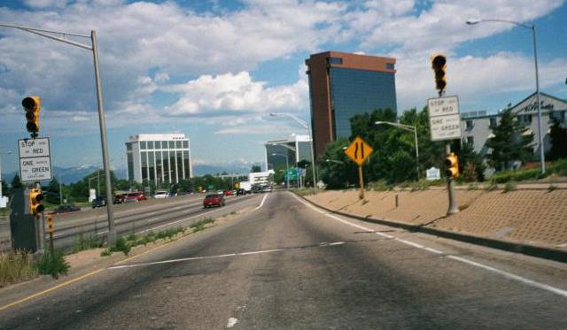
A typical CDOT ramp meter, at the northbound onramp to I-25 at Evans Avenue as it appeared before T-REX construction.

Ramp Meters in Metro Denver

Route

What Onramps Have Meters

Federal Blvd (SH 88):
 • WB

County Line Rd:
 • EB to NB
 • WB to NB
Dry Creek Rd:
 • NB
 • SB
Arapahoe Rd (SH 88):
 • EB to NB
 • WB to NB
 • EB to SB
 • WB to SB
Orchard Rd:
 • NB (with HOV bypass)
 • SB
Belleview Ave (SH 88):
 • NB
 • SB
Hampden Ave (US 285/SH 30):
 • NB
 • SB
Yale Ave:
 • NB
 • SB
Evans Ave:
 • NB (not operating)
 • SB
Colorado Blvd (SH 2):
 • NB
 • SB
University Blvd:
 • NB
 • SB
84th Avenue:
 • SB
Thornton Parkway:
 • SB
104th Avenue:
 • SB

Foothills Pkwy (SH 157):
 • EB
McCaslin Blvd (SH 170):
 • WB
Interlocken Lp/StorageTek Dr:
 • WB
Wadsworth Blvd (SH 121):
 • EB
104th Ave/Church Ranch Blvd:
 • EB
Sheridan Blvd (SH 95):
 • EB
Federal Blvd (US 287):
 • EB
Pecos St:
 • EB

Route

What Onramps Have Meters

Kipling St (SH 391):
 • EB
Havana St:
 • WB
Peoria St:
 • WB
E-470:
 • WB (not operating)

Tamarac St/DTC Blvd:
 • SB
 • NB
Yosemite St:
 • NB
Parker Rd (SH 83):
 • NB
Iliff Ave:
 • EB to NB
 • WB to NB
 • WB to SB
 • EB to SB
Mississippi Ave:
 • NB
 • SB
Alameda Ave:
 • NB
 • SB
6th Ave (SH 30):
 • NB
 • SB
Colfax Ave (US 40-287/BL I-70):
 • NB
 • SB

York St:
 • EB

Quincy Ave:
 • WB
Bowles Ave:
 • WB
Wadsworth Blvd (SH 121):
 • EB
Santa Fe Dr (US 85):
 • WB
Lucent Blvd:
 • WB
Broadway:
 • EB
 • WB
University Blvd (SH 177):
 • EB
 • WB
Quebec Street:
 • WB

Ramp Meters Outside Metro Denver

Route

What Onramps Have Meters

Hidden Valley/Central City Pkwy (Exit 243):
 • EB (not operating)

Continue:

Created 13 May 2001
Last updated 11 September 2006