|

|
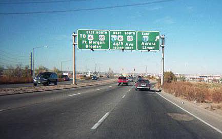
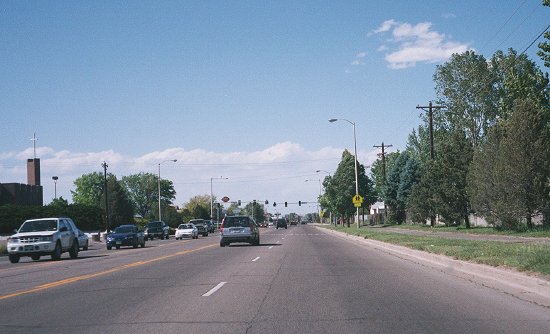
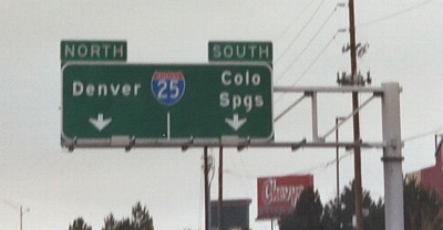
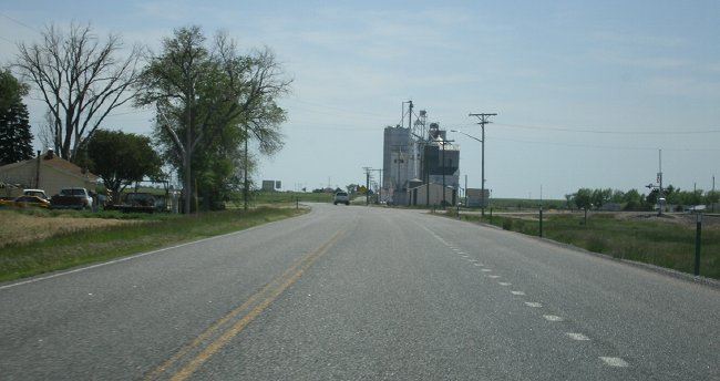
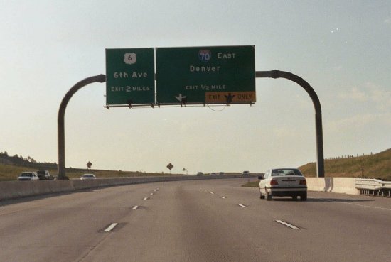
- Colorado Blvd./I-70.
Northbound Colorado Boulevard (SH 2) at I-70 in Denver. This
sign structure does not exist anymore. October 1999
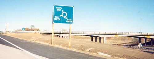
- Sable Blvd./120th Ave.
Roundabout. A blurry picture of a sign on northbound
SH 2 approaching a roundabout at 120th Avenue that does not
exist anymore. October 1999
|
|
|

|
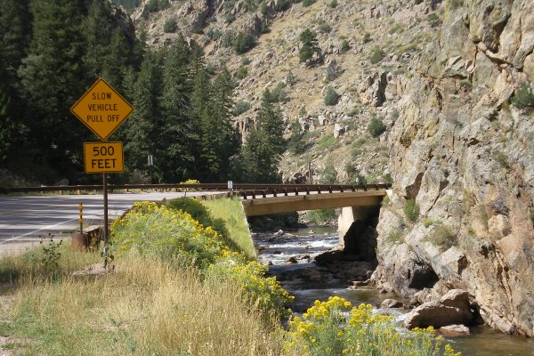
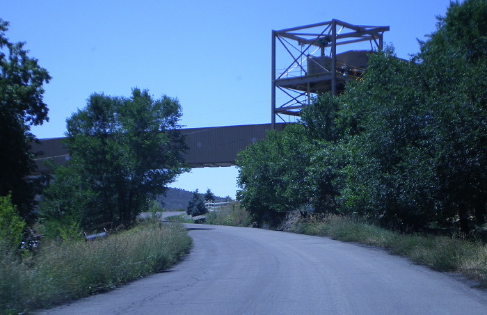
- Watch That First Step, It's a Doozy. And don't let go of the steering wheel. August 2004
-
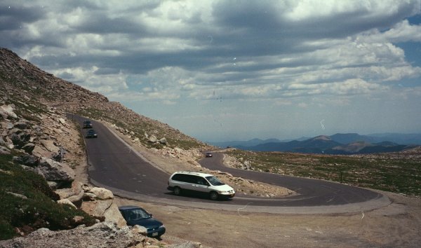
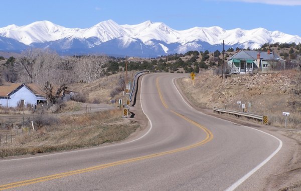
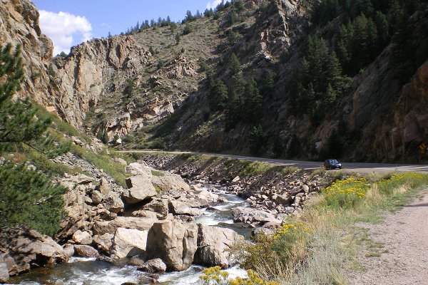
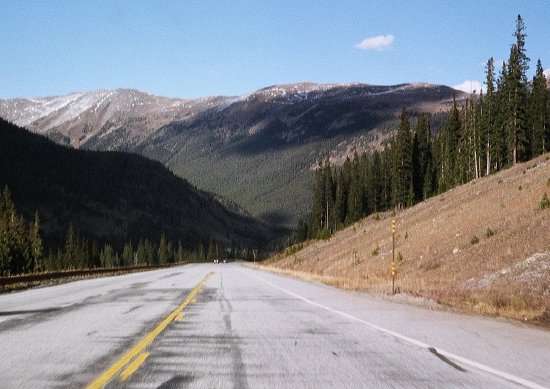
Switchback. One of SH 5's tight switchbacks as it climbs up the south face of Mount Evans. This one is near Milepost 12. August 2004
-
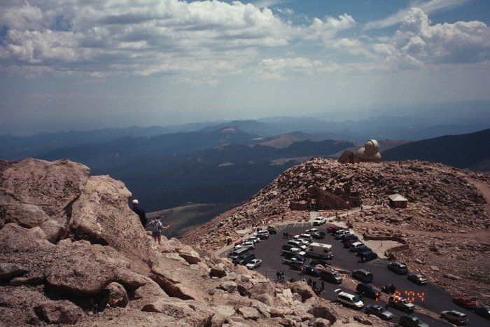
Mount Evans Summit.
Looking northeast from the summit of Mount Evans. 130' below is the
parking area, Crest House and University of Denver observatory. As you
might expect, being at one of the highest points in North America lends
itself to a good view. August 2004
|
|
|
|

|
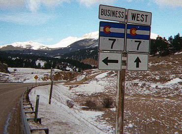
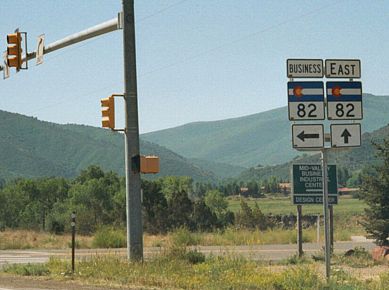
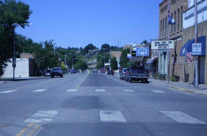
- Business SH 7.
Northwestbound at the turnoff for Ferncliff/Allenspark.
January 1999
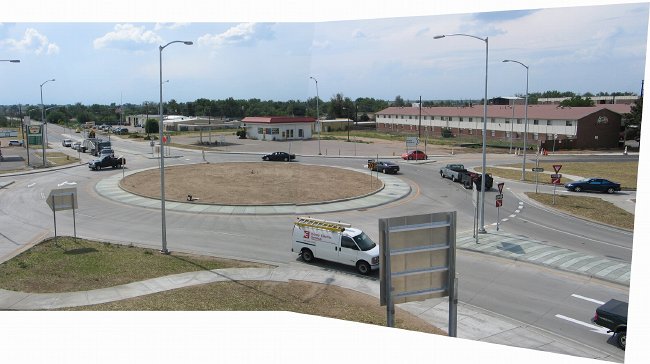
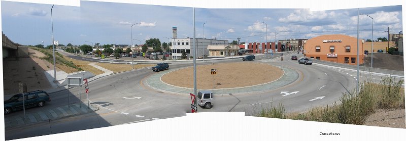
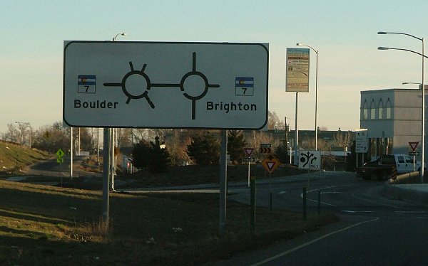
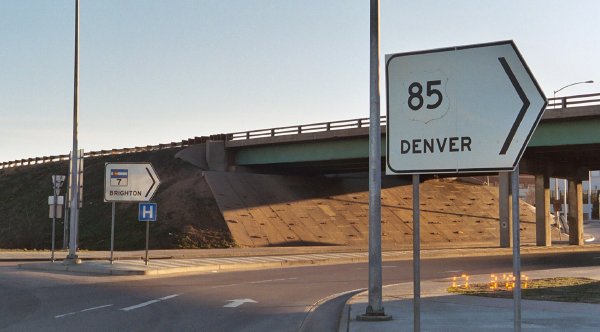
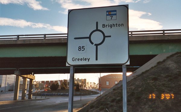
- Brighton Twin Roundabouts - West Side - East Side.
The SH 7/US 85 interchange in Brighton features twin roundabouts on SH
7 at the bottom of the US 85 ramps. The west roundabout not only serves
the ramps but also the west frontage roads, causing additional
entry/exit points on it. The east roundabout barely squeezes in in
between the US 85 overpass and downtown buildings. Photos by Phil
Demosthenes. A point to ponder: In the east roundabout, is the van
disappearing into a roundabout-induced wormhole, or is it just a
consequence of stitching together multiple photos?
|
|
|
|

|
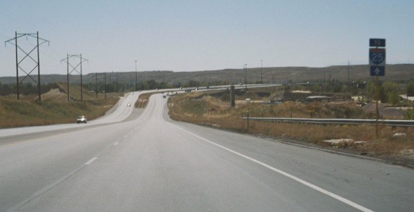
- Interstate Bike Route
76. An Interstate Bike Route 76 sign on southbound
SH 9 approaching US 285 in Fairplay. Apparently this part of
SH 9 is part of a long-distance bike route, but I haven't
seen any other signs for the route in the area, so it's not
marked very well. November 2003
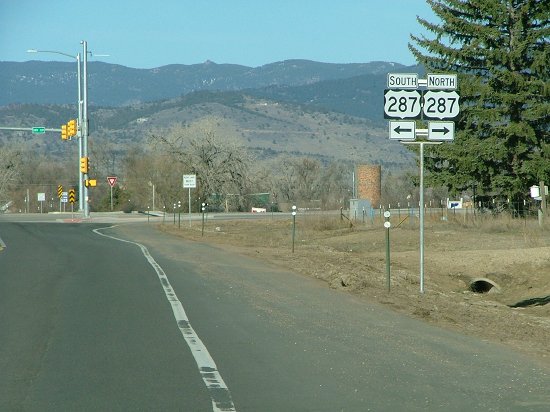
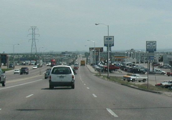
- US 285/SH 9 Signs.
A marker assembly on southbound SH 9 approaching US 285 in
Fairplay. At the intersection itself you can see a signal
installation in progress. November 2003
- Hoosier Pass
Marker. The US Forest Service marker and CDOT
distance sign at Hoosier Pass. November 2003
- Hoosier Pass
Summit. The view looking north on SH 9 from the
summit of Hoosier Pass. November 2003
- SH 9 at I-70. A sign on
southbound SH 9 in Silverthorne for the well-marked overlap
of I-70 and SH 9. June 2002
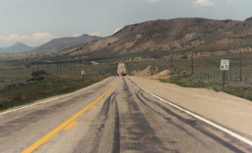
- SH 9 North of
Silverthorne. Northbound on SH 9 at milepost 113,
near Elk Run Road. June 2003
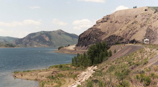
- Green Mountain
Reservoir. Looking north as SH 9 runs beside Green
Mountain Reservoir. June 2003
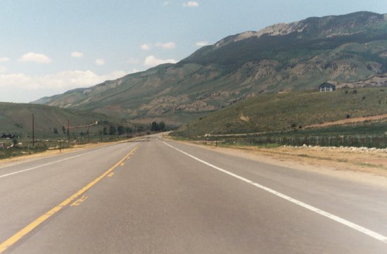
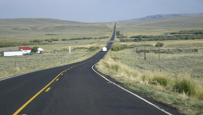
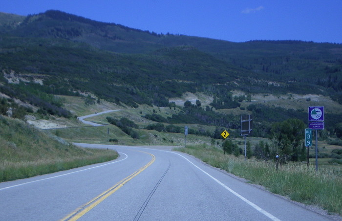
- Near-Desert in Summit
County? Northbound SH 9 at milepost 130. Looks an
awful lot like the semi-arid desert of I-80 in southern
Wyoming, which is not something you would expect in Summit
County. June 2003
|
|
|

|
- Start of SH 12. The starting point of SH 12, looking southwest from US 160. Photo by David Herrera. March 2005
-
West of Trinidad. The scenery looking west along SH 12, about 12 miles west of Trinidad. Photo by David Herrera. March 2005
- Left Turn on San Juan Street.
Westbound SH 12 takes a left turn here from Stonewall Ave onto San Juan
St in Trinidad and is marked with this faded greenboard. August 2010
- Nevada at Animas. This is north on Nevada Ave at Animas St in Trinidad. Turn left here to take westbound SH 12. August 2010
|
|

|
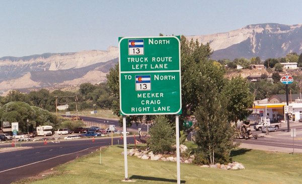
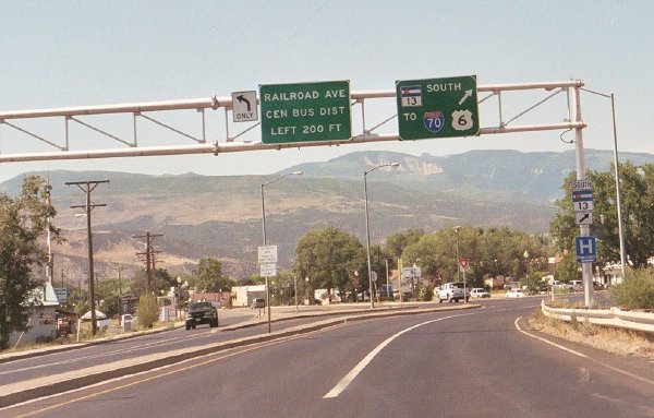
- Through Traffic Has Two Ways to SH 13.
Signage on northbound SH 13 approaching US 6. Trucks are told to turn
left on US 6 to use the bypass west of Rifle, while other traffic can
continue straight ahead on Railroad Avenue through downtown. The route
through downtown is not state-maintained. July 2005
-
North End of Rifle Bypass.
Overhead signage on southbound SH 13 approaching downtown. In this
direction all through traffic is directed onto the bypass. July 2005
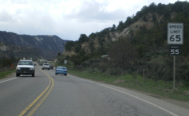
- Night Speed Limit. SH 13 has a 55 mph night speed limit. The limit was implemented in an effort to reduce auto-wildlife collisions. May 2008
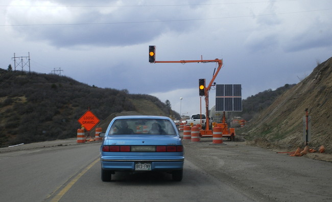
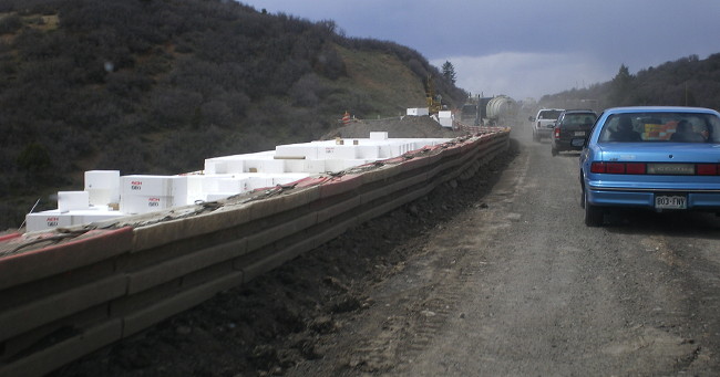
- Rio Blanco Divide Construction: Temporary Signal • Foam Blocks for Fill.
Just south of the Garfield/Rio Blanco County line, a CDOT project was
reconstructing SH 13 at a high fill at Rio Blanco Divide. Traffic was
on a one-lane temporary gravel road. May 2008
- North of Rio Blanco. The view along northbound SH 13 several miles north of Rio Blanco. May 2008
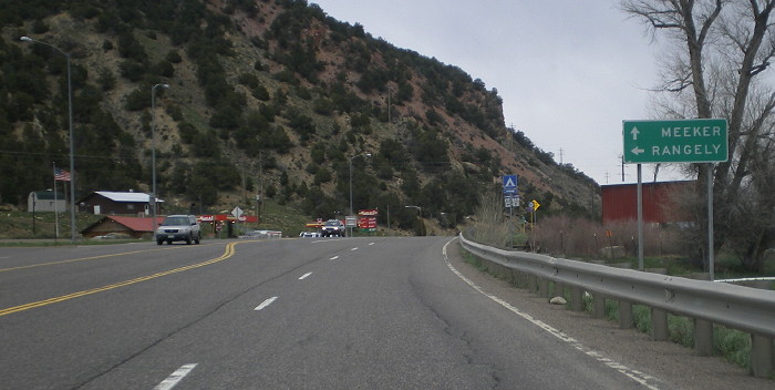
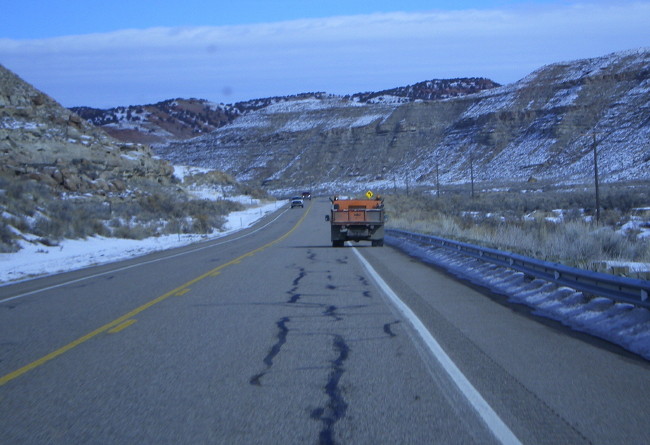
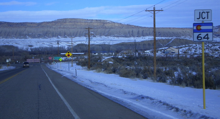
- SH 64 Intersection. Northbound approaching the SH 64 intersection west of Meeker. May 2008
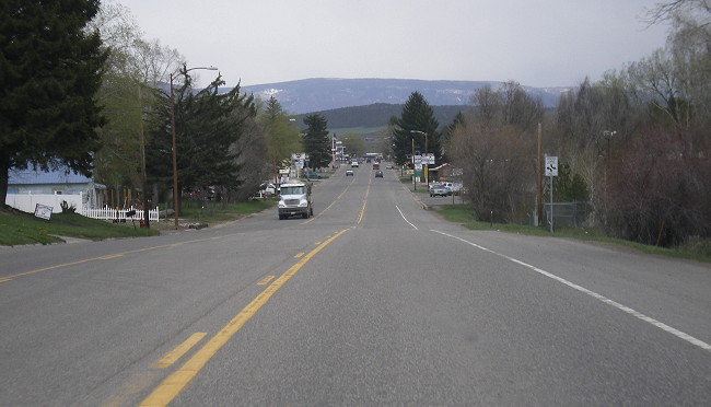
- Meeker. The view along northbound SH 13 as it travels Market Street through Meeker. May 2008
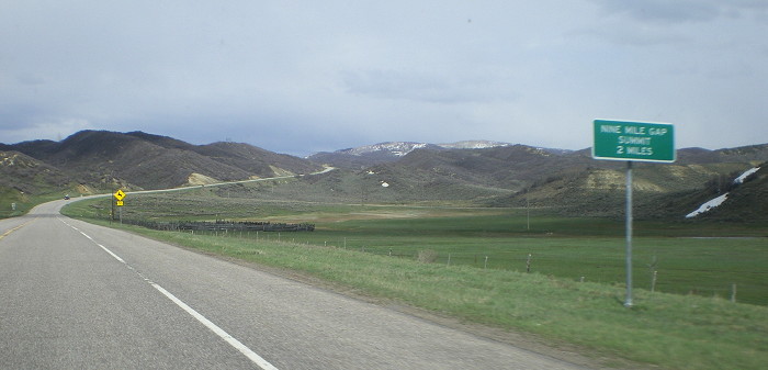
- Nine Mile Gap. The view up northbound SH 13 as it climbs up Nine Mile Gap 9 miles north of Meeker. May 2008
- Iles Mountain Striations. Southwest of Hamilton northbound SH 13 gets this view of geologic history in the side of Iles Mountain. May 2008
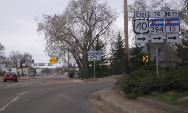
- Craig Eastbound One-Way Split. Signs at the hard right turn where eastbound US 40/SH 13 splits onto its two one-way streets in Craig. May 2008
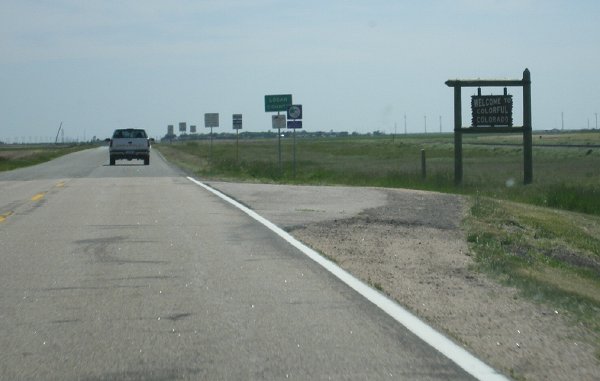
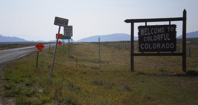
- Wyoming Border.
At the Wyoming border SH 13 comes into Colorado and drops down into the
valley of Timberlake Creek. Up ahead you can see the "Welcome to
Colorful Colorado" sign. May 2008
|
|
|
|

|
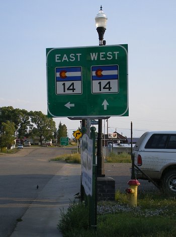
- Leaving US 40.
This shot looks northeast down SH 14 as it leaves the intersection of
US 40. The picture illustrates how unconventional of a pass Muddy Pass
is, as the intersection is at the "summit" of the pass but SH 14 barely
descends at all from it. September 2007
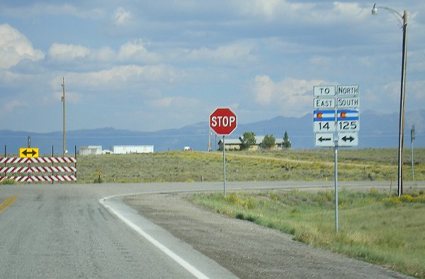
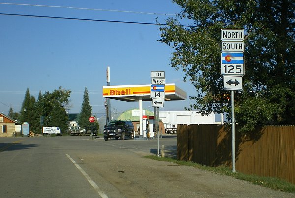
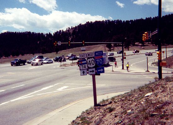
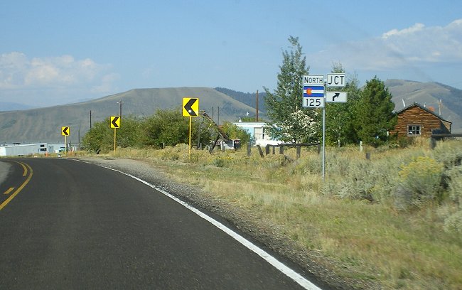
- SH 125 Eastbound. Eastbound on SH 14 as it approaches the intersection with SH 125 south of Walden. September 2007
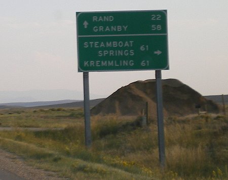
- SH 125-14 Split, Going to Kremmling or Steamboat?
Then it's the same distance. That's not something you might realize (I
didn't), but from the Muddy Pass intersection, it's the same distance
either direction to Kremmling or Steamboat Springs. September 2007
- Markers for the SH 125-14 Overlap. These markers are at the intersection of SH 125-14 and CR 12W just west of Walden. September 2007
- Northbound in Walden, SH 125-14 Split • Markers • Towns. As SH
125-14 turns onto Main Street on the south side of Walden, it
immediately encounters the SH 14 turnoff at 6th Street. The markers
photo shows the sign at a funky angle because of the curve just south
of the intersection. The photo of the towns sign shows a goofed-up sign
with different letter heights. September 2007
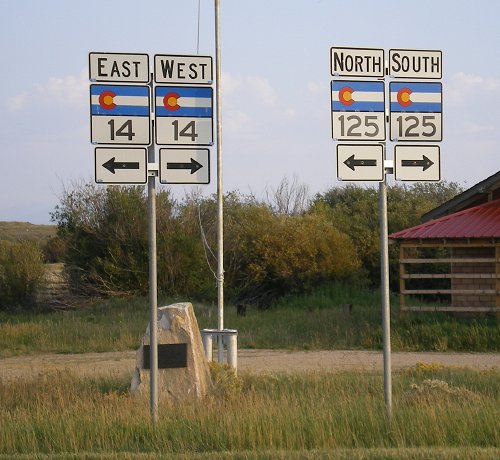
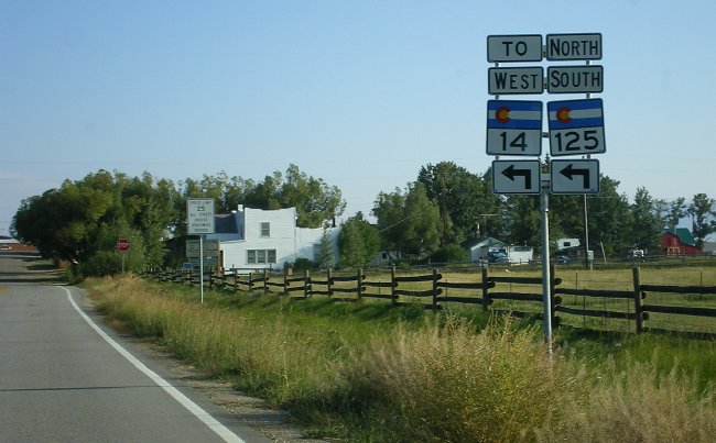
- SH 125 Westbound.
Westbound on SH 14 on 6th Street in Walden as it comes to the
intersection with SH 125 at Main Street. Not sure they need the "TO"
over the SH 14 marker.And the north and south over the 125 marker seem like overkill to me, but whatever. September 2007
- Walden, Washington to 6th Left Turn.
These markers are on westbound SH 14 in Walden, on northbound
Washington Street as it comes up to the left turn at 6th Street. Again
the redundant north and south over the 125 marker. September 2007
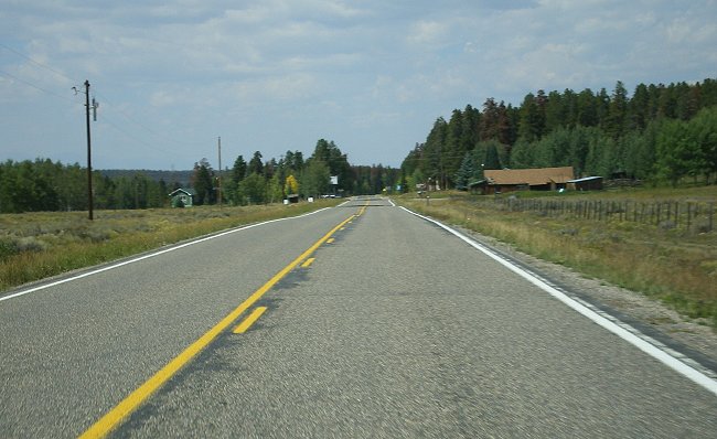
- Gould. Westbound SH 14 as it approaches the settlement of Gould. September 2007
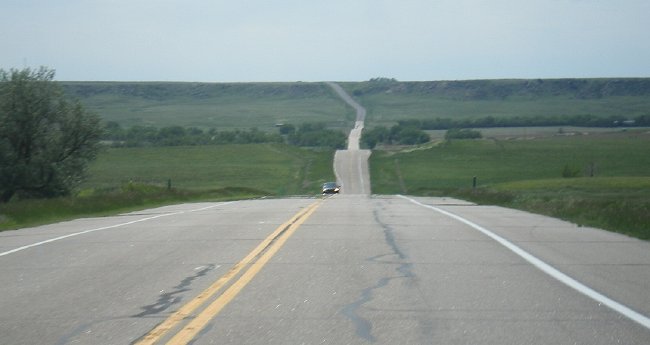
- Cameron Pass West Side, Colorado State Forest.
A scenic overlook is on the west side of Cameron Pass, allowing this
view looking west on SH 14 out over the Colorado State Forest. September 2007
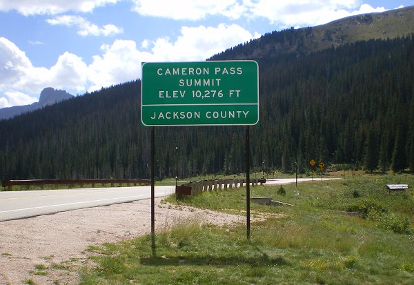
- Cameron Pass Summit. The view at the summit of Cameron Pass on westbound SH 14. September 2007
- A Couple Miles East of Cameron Pass • Uphill • Downhill.
Two shots on the east side of Cameron Pass, one looking uphill and the
other downhill. In the uphill picture you can see the Nokhu Crags rock
formation on the horizon. September 2007
- Poudre Canyon "Big Narrows" • Bridge • View.
Here's two shots in the Big Narrows of the Poudre Canyon at about
Milepost 104 west of CR 27. The bridge picture shows a bridge as viewed
heading west that takes SH 14 over to the other bank of the Poudre
River. The perspective makes it look like you're going into a rock
wall! The view shows the the scenery looking east at the same location. September 2007
- CR 27/Stove Prairie Turnoff. The view on eastbound SH 14 as it approaches the CR 27/Stove Prairie turnoff in Poudre Canyon. September 2007
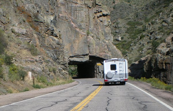
- Poudre Canyon Tunnel. The unlined, hard rock tunnel on westbound SH 14 in Poudre Canyon at Milepost 107, east of CR 27. September 2007
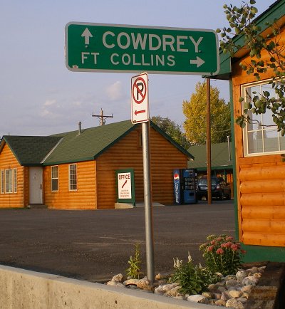
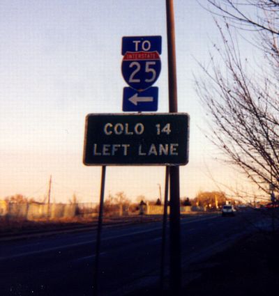
- Colo 14 Left
Lane. Unusual sign where the route is spelled out
rather than a marker shown. Eastbound on Riverside Avenue in
Fort Collins. December 1997
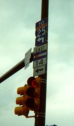
- SH 14/I-25
Arrows. A little mix-up of the arrows that should be
under the shields at Riverside and Mulberry Street. June
1998
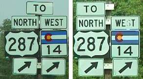
- SH 14/To US 287
Right. Two separate pictures of two separate signs
in the same image showing how the "TO" tab has moved.
Westbound Mulberry approaching Riverside. Photos taken by
Mike Ballard.
- SH 14/I-25. Westbound
SH 14 coming off the I-25 overpass. Photo taken by Mike
Ballard.
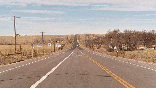
- Heading West From Briggsdale. The view looking west along SH 14 from SH 392 at Briggsdale through the dip for Crow Creek. March 2007
- Pawnee Creek and Pawnee Hills.
Westbound SH 14 west of Sterling. Here the view shows SH 14 dipping
down into the valley for Pawnee Creek and climbing the Pawnee Hills on
the other side. May 2007
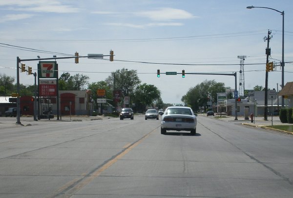
- Main Street, Sterling. Westbound on SH 14 along Sterling's commercial strip on West Main Street. May 2007
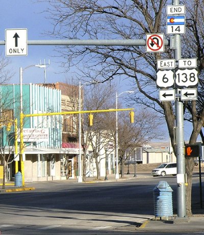
- End SH 14 at US 6.
Photo of the signage at SH 14's east end at US 6 (3rd and Main) in
Sterling. Note a trailblazer is provided to guide traffic to US 138,
only 2 blocks to the north. Photo by Dale Sanderson. March 2006
|
|
|
|

|
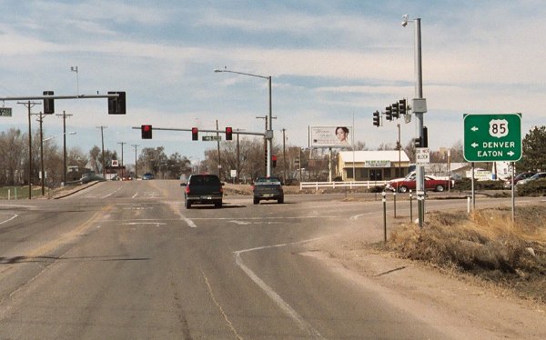
- Signs on US 85. Marker
assembly on northbound US 85 at the eastbound SH 16 ramp.
You can also see the overpass for SH 16 going over US 85 and
the railroad. September 2003
|
|
|

|
- New Mexico Border. Northbound at the mini welcome sign as NM 17 enters Colorado. August 2010
- Southbound Cumbres Pass Descent. The view descending down Cumbres Pass toward New Mexico. August 2010
- Cumbres Pass Summit: Modern Marker • Historic Marker • View Southbound.
The SH 17 summit of Cumbres Pass also features a rail crossing of the
C&TSRR and a station house. The historic marker is attached to a
boulder adjacent to the station house parking lot. August 2010
- Open Range. Cattle on SH 17 in an open range section between La Manga and Cumbres passes. August 2010
- La Manga Pass Summit: Marker • Southbound SH 17. Two pictures at the summit of La Manga Pass. August 2010
- Green Splendor of the Rio Grande National Forest.
This vantage point near a switchback on the north side of La Manga Pass
looks out over another level of SH 17 below, and northwest further up
the Conejos River valley. August 2010
- Climbing La Manga Pass, Conejos River Bridge.
Westbound SH 17 at the point it leaves the Conejos River valley,
crossing it on a bridge, and begins climbing up toward La Manga Pass. August 2010
- Conejos River Valley. Westbound SH 17 as the valley for the Conejos River gets narrower, west of Antonito. August 2010
|
|
|
|

|
DEFUNCT HIGHWAY
- SH 18. SH 18 at its
west end looking east. When the picture was taken, this was
Colorado's shortest state highway. It ended at the I-25
interchange to the lower left of the barn. SH 18 was turned
back in 2000. July 1998
|
|
|

|
- US 385 Intersection. Approaching the stop sign at US 385 just north of Holyoke. May 2011
- Nebraska Border.
Looking into Colorado at the Nebraska border. I find it somewhat unusal
that CDOT decided to put in a large welcome board at this low-volume
border crossing. May 2011
|
|
|
|

|
DEFUNCT HIGHWAY
- SH 26/CR 93. SH 26 at
Hogback Road north of Morrison. Unusual county route marker.
This intersection is no longer part of SH 26. May 2001
|
|
|
|

|
DEFUNCT HIGHWAY
- End at US 85. Signs
on westbound SH 29 at US 85. The "To" on the left US 85
marker is due to a short section of US 85 in south Colorado
Springs that has been turned back to the city. Photo by
Russell Kroll. May 2003
- I-25 Interchange.
Looking west through the I-25 interchange along SH 29, from
a pedestrian overpass on the east side of it. September 2003
- Airport Road.
Looking east along SH 29's Airport Road section. September
2003
|
|
|

|
- Tamarac Drive and Mount Evans.
This pictures shows a lot. It's looking west along Hampden Avenue/SH 30
near Ulster Street toward Tamarac Drive. The sizable depression Hampden
is descending into is the sorta-valley of Goldsmith Gulch. Take note of
Hampden's 8-lane width with continuous left turn lanes. Off on the
horizon you can see snow-covered Mount Evans. January 2004
|
|
|
|

|
- SH
35/Smith Road. Quebec Street, as seen looking
southward toward the Smith Road overpass from the Sandown
Road overpass. When this picture was taken it was still
part of SH 35. May 1999
- SH
35/MLK Jr. Boulevard. Southbound Quebec Street at
eastbound Martin Luther King Jr. Boulevard. Here one
would turn left to get into Stapleton. Note that it is a
triple-left turn. The Quebec/MLKJ intersection is
actually four separate signals, because the two
directions of each street split into separate roadways.
When this picture was taken this was the south end of SH
35. October 1999
- SH
35/Sand Creek/Quebec. The array of overhead signs
near the end of the I-270 Quebec offramp. August
2003
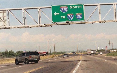
- I-270
Overhead Sign. A large overhead sign at the left
turn for northbound Quebec to westbound I-270. Oops! It
says 270 "North". August 2003
|
|
|
|

|
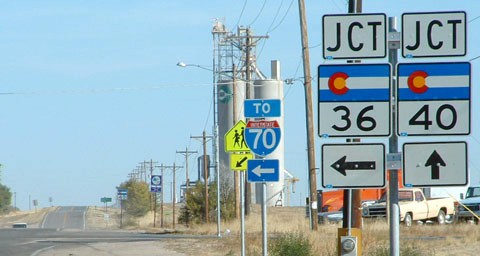
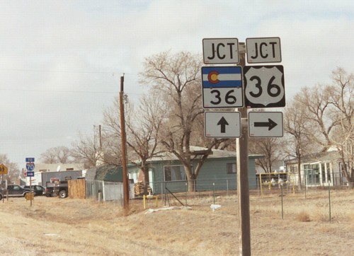
- SH 36/SH 40 Markers,
Byers. Marker assembly on eastbound SH 36 in Byers.
The 36 sign should be a US marker, not state. Photo by Dale
Sanderson. October 2003
|
|
|

|
DEFUNCT HIGHWAY
|
|
|
|

|
- SH 36/US 36 Markers,
Byers. Unusual marker assembly on westbound SH 40 in
Byers. February 2003
- End Pavement Near
Limon. Northwestbound on the Limon section of SH 40,
here at the end of pavement northwest of the west Limon
intersection. This point also appears to correspond to the
end of state maintenance. Photo by Dale Sanderson. December
2003
- SH 40/To West I-70.
Picture on westbound SH 40 just west of the US 24-40-287/BL
70/Spur 24 intersection northwest of Limon. Note the gate
that can be closed in event of severe winter weather.
According to Dale Sanderson as of December 2003 these signs
no longer exist. Photo courtesy Robert Halonen.
|
|
|

|
- Near Northern Avenue. SH 45 (Pueblo Boulevard) northbound north of SH 78/Northern Avenue. Here SH 45 is low-speed commercial strip. May 2004
|
|
|

|
|
|
|

|
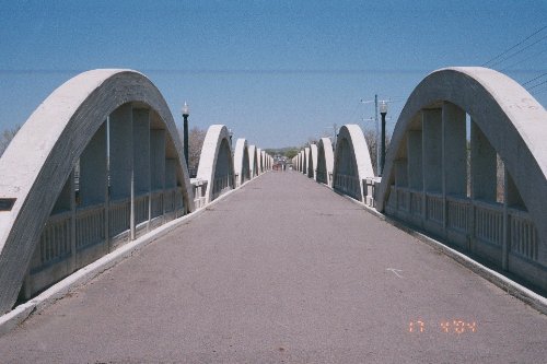
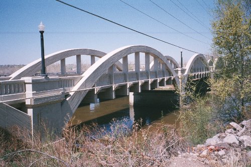
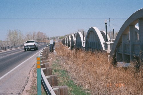
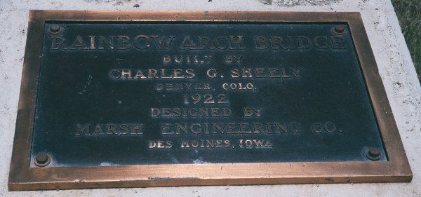
- Fort Morgan Rainbow Arch Bridge Straight On • Side • Replacement Structure • Plaque.
The Rainbow Arch Bridge, on SH 52 just north of I-76 over the South
Platte River, was built in 1922. The concrete arches, rather than being
totally above or below the deck, are partly on either side. The
replacement structure was built in 1963 right next to it. I paced off
the deck at only 20' wide, no wonder it had to be replaced. The bridge
now serves as part of a walking path that ties to an adjacent city
park. April 2004
|
|
|
|

|
- US 138 End. Signs at the right turn for SH 55 to US 138 in Crook. May 2007
- I-76 Overpass.
Southbound on SH 55 approaching the I-76 interchange and overpass. In
the distance are the hills SH 55 climbs as it exits the South Platte
valley. May 2007
- Northbound SH 55. A couple miles south of I-76 on northbound SH 55 as it descends down the rollings hills into the South Platte valley. May 2007
- End SH 55. SH 55's south
end south of I-76. There's no intersection, the state highway simply
ends and becomes a county road. The road continues off in the distance
toward Fleming. May 2007
- Begin SH 55. SH 55's south beginning point, with it curving off for its drop down into the South Platte valley. May 2007
|
|
|
|

|
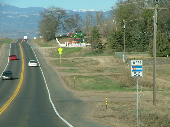
- Old End SH 56. Westbound
SH 56 at its former west end west of Berthoud. You can see a blurry
SH 56 End sign on the right.
- Westbound at US 287. Signs on westbound SH 56 at the US 287 bypass west of Bethoud. Photo by Dale Sanderson. March 2007
- Heading West from I-25. The view at the beginning of SH 56 westbound from I-25. Photo by Dale Sanderson. March 2007
|
|
|

|
- Washington Avenue Construction: View down EB SH 58 • View south on Washington • West half of bridge construction.
These are three shots taken while the bridge that takes Washington Ave
over SH 58 was being replaced. A new pedestrian bridge was in place
east of the bridge, while traffic was on one half while the western
half was under construction. January 2009
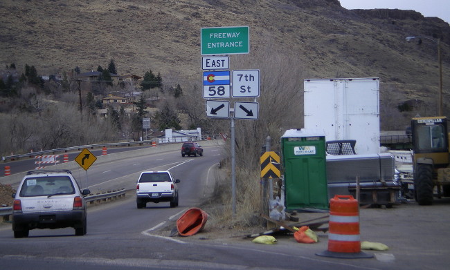
- Eastbound Washington Onramp.
A rare, for Colorado, "freeway entrance" sign at the onramp to EB SH 58
form Washington Ave. When this picture was taken, 7th Street had been
commandeered as a construction staging area. January 2009
- Route Marker Snafu.
This marker assembly on northbound Washington incorrectly uses a US
marker for SH 93. US 93 does exist in the direction indicated, but
Nevada is a long ways away. Photo by Robert Halonen. June 2010
- I-70 Flyover.
A picture taken while on the flyover from eastbound I-70 to SH 58. The
flyover is the top, third level of the interchange. January 2009
|
|
|
|

|
- Seibert. Northbound
on SH 59 approaching the US 24 intersection in Seibert.
Photo by Dale Sanderson. December 2003
|
|
|

|
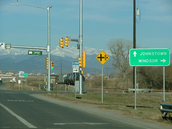
- SH 257 Intersection. Westbound on SH 60 at the SH 257 intersection in Milliken. Photo by Dale Sanderson. March 2007
|
|
|

|
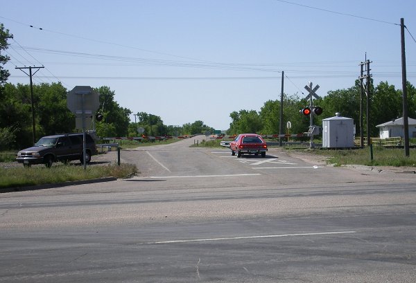
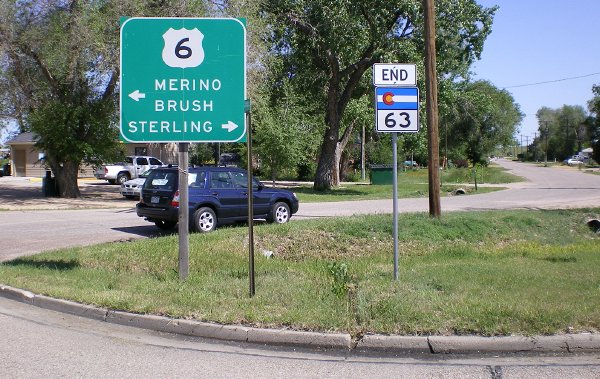
- Atwood Rail Crossing. Looking south from US 6 at SH 63's BNSF rail crossing as a train approaches. May 2007
- End 63/US 6 Signs. Signs at the US 6 intersection for northbound SH 63 traffic. May 2007
|
|

|
- Central Rangely. Westbound on Main Street in the middle of town. January 2009
- Entering Rangely.
Using a lot of the camera's zoom to look all the way through Rangely
and out the other side of town, as one enters on westbound SH 64. January 2009
- Kenney Reservoir. Taylor Draw Dam holds back Kenney Reservoir. Here eastbound SH 64 skirts along its frozen-over south shoreline. January 2009
- Milepost 41. Scenery on eastbound SH 64, about a half-hour from Meeker. January 2009
- SH 13 Approach. Good shot of the marker signs on SH 64 approaching the SH 13 intersection outside Meeker. January 2009
|
|
|
|

|
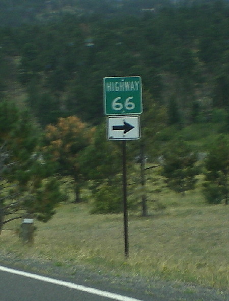
- South End, Estes Park.
Former SH 66's south end south of Estes Park. Photo by Dale
Sanderson.
- Unusual "Highway 66" Marker.
After the Estes Park section of SH 66 was turned back, apparently the
name of the road was kept as Highway 66 rather than becoming a county
road number or something. This is the marker on US 36 that replaced the
state highway marker. You normally don't ever see a marker like this in
Colorado. August 2008
|
|
|

|
- Victor. Southbound SH 67 as it comes into Victor. September 2010
- Gold Mine Tailings Pile.
Here north of Victor, this tailings pile from the gold mine totally
fills the skyline. Gold mining is messy business, as this pile has a
cyanide solution dripping down through it. September 2010
- Bennett Ave, Cripple Creek. Things are hopping in Cripple Creek on this Saturday afternoon. Westbound at 3rd St, on southbound SH 67. September 2010
- Cripple Creek Split Level Street. This median in Cripple Creek, from 3rd to 4th Sts, separates Bennett Ave into two different elevations. September 2010
- Two Ways to Victor.
At CR 81 north of Cripple Creek, drivers on southbound SH 67 get
informed of the two ways to Victor: Right via SH 67 or left via CR 81.
The sign features a rarely seen county pentagon on a guide sign. September 2010
- Fall Colors North of Cripple Creek. The scenery on northbound SH 67 north of Cripple Creek during the height of fall colors. September 2010
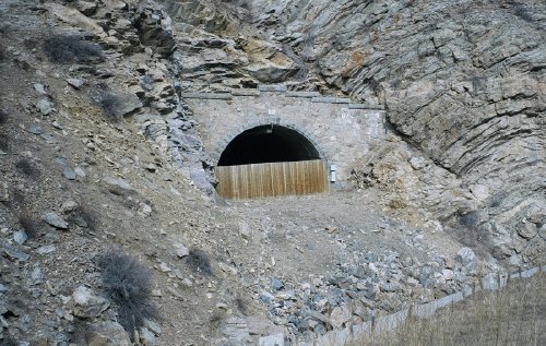
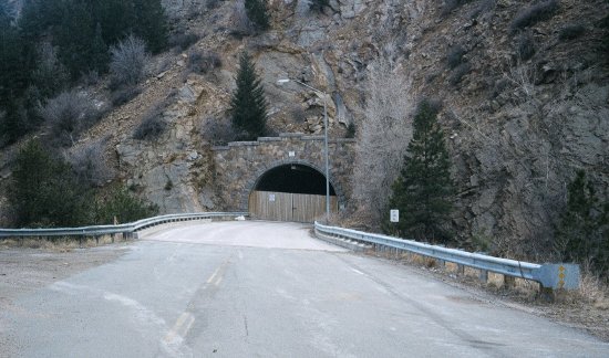
- Waters Tunnel: Bypass Road • South Portal • Interior at South Portal.
The one-lane Waters Tunnel was bypassed in 1993.
The bypass road is visble off to the left curving around the tunnel.
Looking through the portal one can still see interior beams, guardrail,
reflectors and light fixtures. September 2010
- South of Divide. Southbound on SH 67 in the mountainous section between Divide and Cripple Creek. September 2010
- Northbound Approaching US 24. Markers on SH 67 as it comes up to US 24 at Divide, showing the overlap to the east. September 2010
- Woodland Park SH 67 Intersection. The eastbound US 24/SH 67 split features this large destination sign. September 2010
|
|
|
|

|
DEFUNCT HIGHWAY
- SH 68/I-25. Eastbound
SH 68 approaching I-25. A widening project will change what
this looks like. July 1998
|
|
|

|
- Greenhorn Mountain.
View on northbound SH 69 at about Milepost 3, with Greenhorn Mountain
dominating the skyline. Photo by David Herrera. December 2010
- Milepost 35, Humboldt Peak.
Another view on northbound SH 69, about 11 miles northwest of Gardner.
Here the Sangre de Christo's Humboldt Peak is prominent. Photo by David
Herrera. December 2010
|
|
|

|
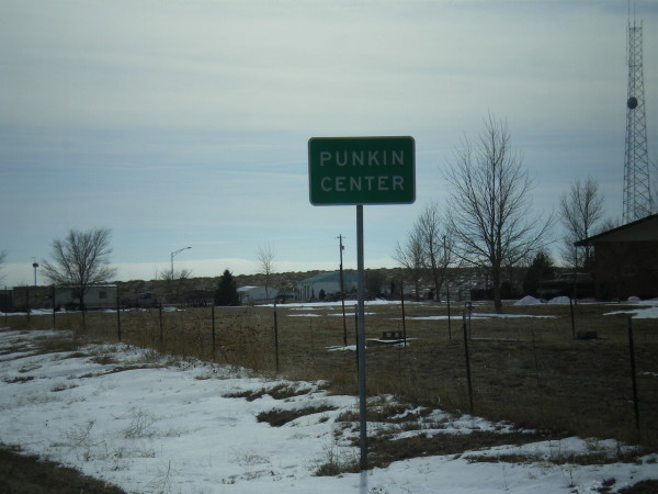
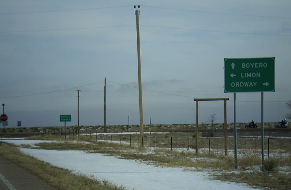
- Punkin Center Sign. How can you not take a picture of it? Southbound approaching SH 94. February 2008
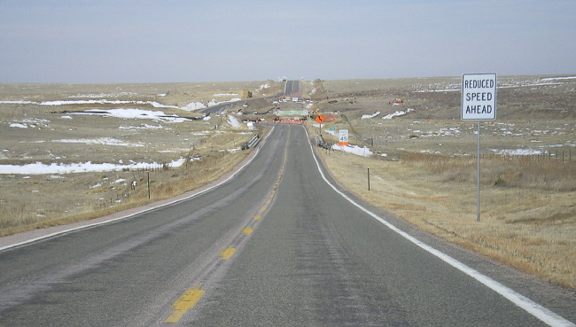
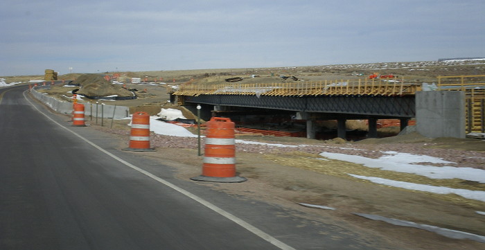
- South Rush Creek Bridge Construction, Approach and Bridge.
In early 2008 CDOT was replacing the SH 71 bridge over South Rush Creek
north of Punkin Center. A temporary bypass took traffic around the west
side of the construction zone. February 2008
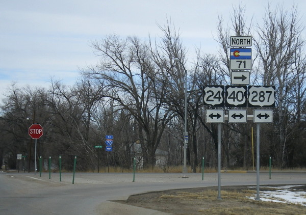
- Limon Marker Assembly.
Northbound SH 71 where it hits Main Street in Limon. There are already
a lot of signs piled onto this marker assembly, and they didn't even
include BL 70. February 2008
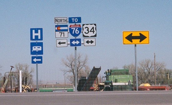
- SH 71 at US 34.
Marker assembly on NB SH 71 at US 34 east of downtown Brush. Note it
says you can go either way to get to I-76 (which is true). April 2004
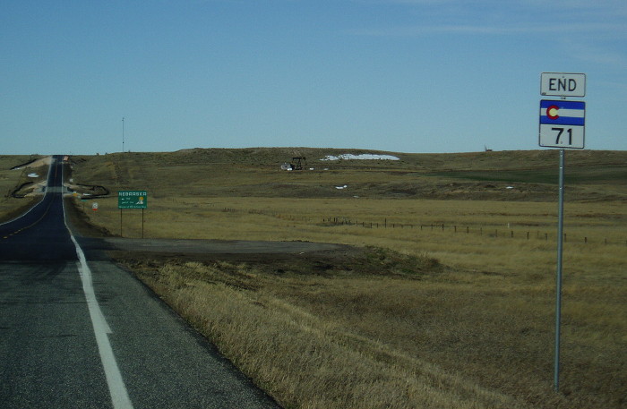
- Nebraska Border.
Shot north on SH 71 at the Nebraska border. Interestingly, CDOT has put
in an "end 71" sign here, although the highway continues in Nebraska as
NE 71. Photo by Bo Baize. November 2009
|
|
|
|

|
- Climbing Up Black Gulch. Eastbound SH 72 about a mile east of Pinecliffe as it climbs up the side of Black Gulch. March 2005
- Pinecliffe Rail Crossing. In this picture looking east you can see where SH 72 crosses the UPRR Moffat Tunnel line, in the town of Pinecliffe. March 2005
- Roundabout
Sign. A sign on southbound SH 72 approaching a
roundabout in Nederland. June 2001
|
|
|
|

|
- El Rancho. The
El Rancho intersection, just south of I-70. May 1999
- SH 74/Bergen
Parkway. Looking north on SH 74 at Bergen Parkway.
May 1999
- Downtown Evergreen.
A shot looking east down SH 74 through "downtown" Evergreen, from the
SH 74/CR 73 intersection. It's typical to not be able to find a parking
spot anywhere. August 2004
|
|
|

|
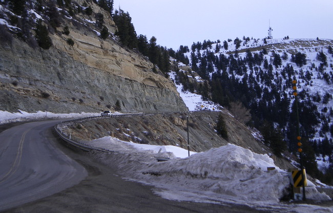
- Gravel Road Up the Wet Mountains. A shot looking westbound on SH 78 at the first switchback after the pavement end. May 2009
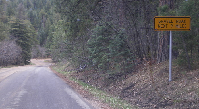
- Gravel Road Next 9 Miles. At the end of the pavement west of Beulah. May 2009
- Pine Drive, Beulah Outskirts. Typical scene on westbound SH 78 west of the Spur 78 intersection. May 2009
- Truckers Better Think Twice.
Warning sign on westbound SH 78 after the Spur 78 intersection, telling
truckers they might not be able to make it around the switchbacks. May
2009
- Spur 78 Approach Sign 1 and Sign 2.
The two signs on westbound SH 78 approaching the Beulah spur. Note the
spur route is actually marked with a business banner even though CDOT
defines it as a spur route. May 2009
- North Saint Charles River Bridge. Westbound on SH 78 coming down the hill to the bridge over the North Saint Charles River east of Beulah. May 2009
- Milepost 29. The scenery on westbound SH 78 at Milepost 29, a few miles outside Pueblo. May 2009
|
|
|

|
- Westbound Spur Route. Westbound on Spur 78 coming in to the main part of Beulah. May 2009
- End Spur 78. The sign at Pennsylvania Ave marking Spur 78's end. May 2009
- Begin Spur 78. Looking back east. Note the sign say "east" rather than spur or business. May 2009
|
|
|
|

|
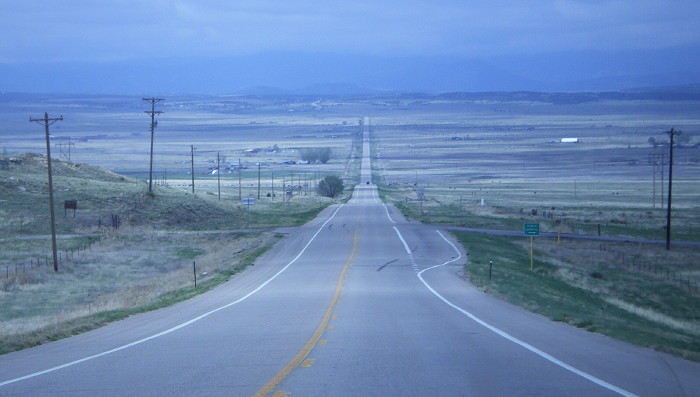
- Typical SH 79. Nortbound
on SH 79 in Adams County. The power poles stretch all the
way to the horizon in this pancake-flat area. February 2003
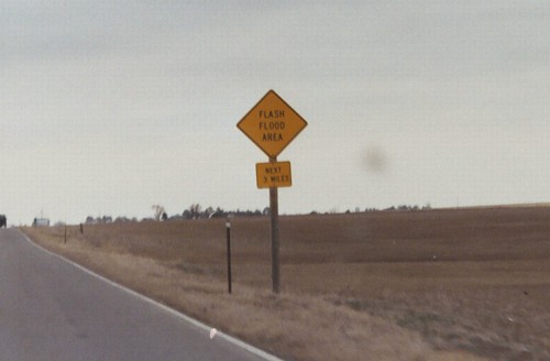
- Flash Flood Area.
Ominous sign on northbound SH 79 in Adams County. Not much
in the way of streams out here, so I guess the water just
kind of pools around, prompting the need for this sign.
February 2003
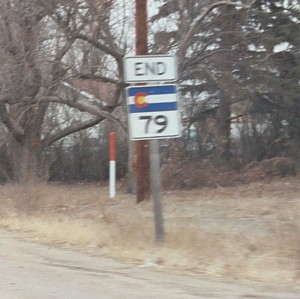
- End SH 79. Northbound
sign on the approach to SH 52 in Prospect Valley. February
2003
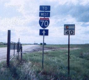
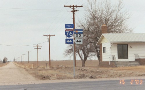
- SH 52 & I-76, Either
Way. Sign at the intersection of SH 79 and SH 52.
February 2003
|
|
|
|

|
- Glenwood Viaduct.
The viaduct that takes SH 82 over the Colorado River, I-70
and a Union Pacific railroad. June 2002
- Grand Avenue.
Looking from the viaduct south on Grand Avenue (eastbound on
SH 82) into downtown Glenwood Springs. June 2002
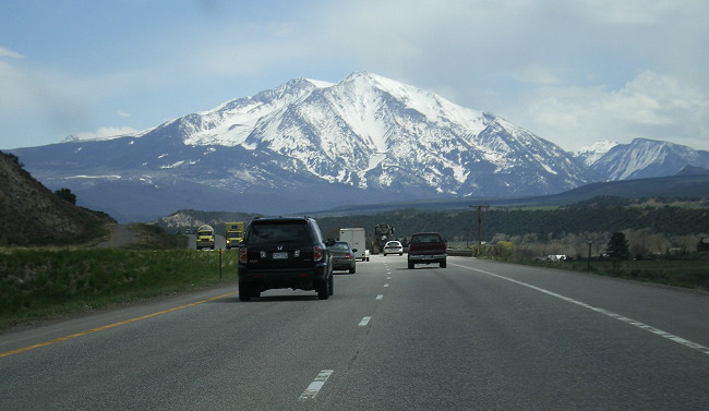
- Mount Sopris. Eastbound approaching Carbondale traffic is oriented right at 12,952' Mount Sopris. May 2008
- BR
82 Marker Assembly. The intersection on eastbound
SH 82 where the Basalt business route used to split off. June
2002
- HOV
Sign. Picture of an HOV sign on eastbound SH
82 southeast of Basalt. May 2008
- Snowmass Canyon: Eastbound Hillside Retaining Walls • Westbound with Eastbound Viaduct • Westbound with Eastbound Walls.
Southeast of Snowmass SH 82 goes through a narrow portion of the
Roaring Fork River valley known as Snowmass Canyon. The widening of SH
82 to four lanes took a form inspired from Glenwood Canyon, with the
eastbound road above the westbound road on bridges and retaining walls. May 2008
- Maroon Creek Bridge: This trestle structure on the west side of
Aspen was originally built as a railroad bridge. Here's a
short history from Michael McMullen: Built in 1888 for
the Colorado Midland Railroad, it was converted to
highway use with a wood deck system about 1916. The wood
deck and beams were replaced with steel girders and
outrigger struts about 1963 with a corrugated metal deck.
The corrugated metal deck was replaced in 1993 with a
glued laminated panel system due to maintenance problems
with the corrugated metal. Photo from Michael McMullen.
- Aspen. On SH 82 at
Monarch Street in Aspen. June 2002
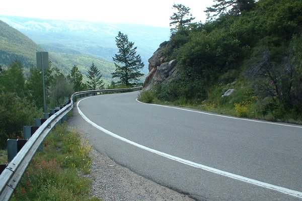
- Two-Lane Road, Only 1 1/2 Lanes Wide.
This is one of several too-narrow-for-a-centerline segments on the west
side of Independence Pass. It's a two-way road, but not wide enough to
stripe two lanes. Be careful on those blind curves! July 2004
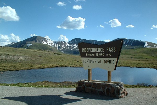
- Independence Pass Summit.
The marker at the summit of Independence Pass, looking south-southwest
across mountain meadows to more peaks in the Sawatch Range. July 2004
|
|
|
|

|
- Academy Boulevard Freeway
Section. Southbound Academy Boulevard just south of
Drennan Road. From here to the signals at I-25 Academy is a
freeway. This is no longer part of SH 83. September 2003
- SH 83/US 24 Marker
Mistake. A marker assembly on southbound Academy
Boulevard south of Platte Avenue. The assembly still
mistakenly included "West US 24" from a short time in the
mid-1990's when US 24 used Academy to get between Platte and
Fountain. The picture also gives a good view of the
gasoline-alley character of Academy Boulevard. This is no longer part of SH 83. Photo by
Russell Kroll. May 2003
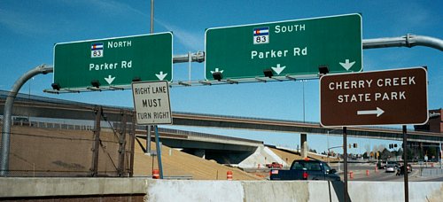
- Parker Road/E-470.
Southbound on SH 83 at E-470. May 1999
- Parker Road/I-225.
Looking north at the interchange, you can see the flyover
from northbound 83 to southbound 225. March 2002
- Triple Left/Triple
Right. Northbound I-225 offramp to 83. March 2002
- Triple Right
Light. Cars waiting at the light for the triple
right. March 2002
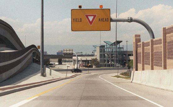
- The Biggest "Yield
Ahead" Sign You'll Ever See. On the ramp from
southbound I-225 to northbound Parker Road/SH 83. The bottom
of the ramp dumps you directly into the right lane of
Parker, hence the need for the yield. The picture doesn't do
justice to how huge this thing is. There are even flashing
beacons and rumble strips. August 2003
|
|
|
|

|
- I-25/SH 88 Markers.
A sign assembly on eastbound Belleview Avenue (SH 88) at the
I-25 interchange, which bucks normal CDOT practice and sort
of marks a state highway along an Interstate. February 2003
- Arapahoe Road Overhead
Sign. An overhead sign on eastbound Arapahoe Road
where a C-D road splits off at the I-25 interchange.
February 2003
- Triple Left, Double
Through, Single Right. Lane assignment sign on
eastbound Arapahoe Road (SH 88) on the approach to Parker
Road (SH 83). February 2003
- Arapahoe/Parker Triple
Left. A picture of the Arapahoe Road/Parker Road
intersection, showing the triple left for eastbound to
northbound traffic. December 2001
|
|
|

|
- Climbing Fremont Pass. Northbound on SH 91 climbing up the south side of Fremont Pass, looking toward Climax, visible in the left middle. October 2004
- Northbound at Clinton Creek.
The view after a fall snowstorm looking north on SH 91 at Clinton
Creek. This is north of Climax as SH 91 descends Tenmile Creek.
September 2006
-
Descending Tenmile Creek. Northbound on SH 91 north of Climax as it falls with Tenmile Creek toward I-70. October 2004
|
|
|

|
- Central Hotchkiss. Westbound on Bridge Street as SH 92 goes through Hotchkiss. August 2009
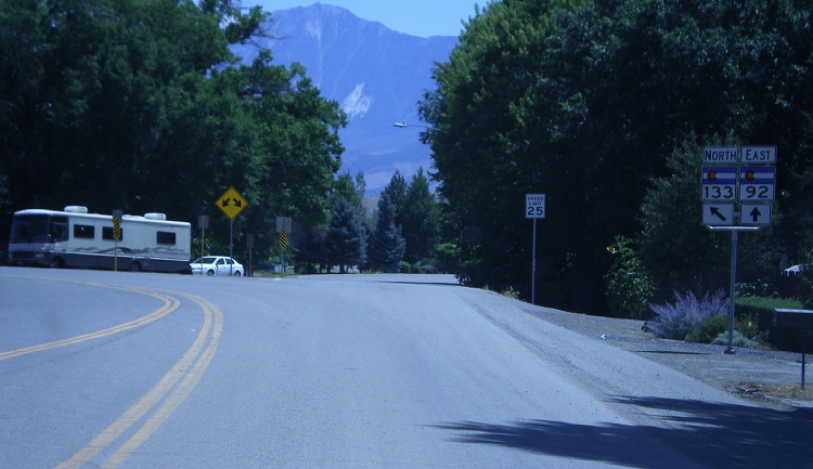
- SH 133 Junction. Signage at the intersection as SH 133 veers left from SH 92 in Hotchkiss. August 2009
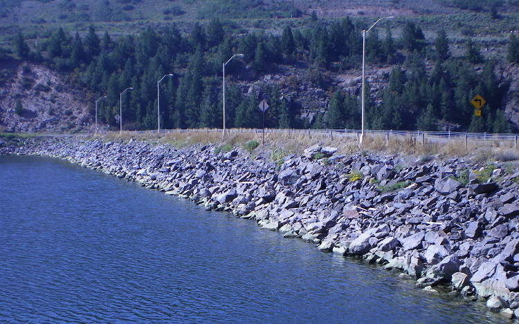
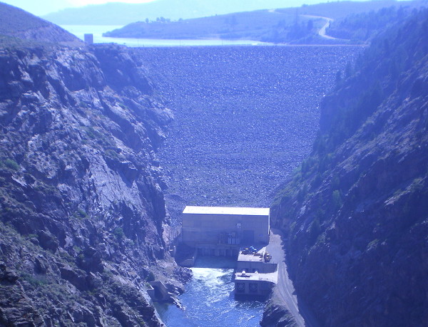
- Blue Mesa Dam Crest and Downstream Face.
Just before its end at US 50, SH 92 crosses the crest of Blue Mesa Dam,
a 390-foot tall earth and rock dam. The outlet features two hydropower
turbines that produce 86 MW for the Western Area Power Authority. August 2009
|
|
|
|

|
- Broadway at CU. View
north on Broadway (SH 93) in Boulder as it passes CU near
18th Street. August 2003
|
|
|

|
- Pikes Peak Filling Your Windshield.
Westbound SH 94 has the fortune of being oriented directly at Pikes
Peak. This shot shows the view looking west near Blaney Road as SH 94
drops down into the Jimmy Camp Creek valley. February 2008
- Entering Punkin Center.
Eastbound SH 94 as it comes toward the SH 71 intersection. The few
buildings in the shot are all of Punkin Center. February 2008
- SH 71 Destinations. Eastbound SH 94 approaching SH 71, with the destination sign. February 2008
|
|
|
|

|
- Wet Mountain Valley.
This picture faces west on SH 96 a couple miles east of Silver Cliff,
looking out across the Wet Mountain Valley and the towns of Westcliffe
and Silver Cliff. At the horizon are the Sangre de Cristo Mountains
with Spread Eagle Peak in the middle. Photo by David Herrera. November
2006
- Old-Style SH 96
Marker. A 1960's-style SH 96 marker which is in
surprisingly good shape. Southbound Santa Fe Avenue
approaching 4th Street in Pueblo. The marker might be left
over from when Santa Fe was part of BR US 50 north of 4th,
but I don't know for sure whether Santa Fe ever was part of
BR 50 north of 4th. Or the marker might have been put in
since traffic on SB I-25 wanting to get to SH 96 is told to
get off at 6th and then has to head south on Santa Fe two
blocks. Photo courtesy Steve Riner.
- Eastbound at US 50.
Marker assembly on eastbound SH 96/4th St. at the interchange with US
50/SH 47. Note the continuation of SH 96 along EB US 50 is marked. May
2004
|
|
|

|
- Echo Lake. Looking north on SH 103 as it passes along side Echo Lake. (August 2004)
|
|
|
|

|
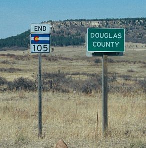
- End at Palmer Lake. The
north end of SH 105's south section on the north side of
Palmer Lake. March 2002
|
|

|
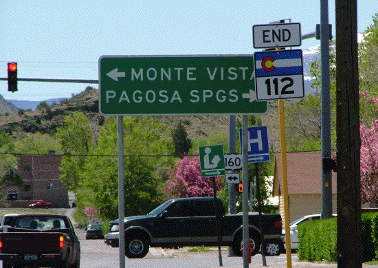
- End at US 160.
A shot of the signs on westbound SH 112 approaching US 160 at Oak
St/Grand Ave in Del Norte. Photo by Dale Sanderson. May 2008
|
|
|

|
- South Platte Valley. Southbound on SH 113 as it makes its final descent into the South Platte Valley approaching US 138. May 2007
- South of Peetz. Southbond SH 113 as it loses elevation coming down from the "Peetz Table" south of town. May 2007
- Peetz. The grain elevator is visible as southbound SH 113 goes through Peetz. May 2007
- Nebraska Border.
Southbound SH 113 as it changes from N-19 at the Nebraska border. This
crossing features a smaller version of the state welcome sign. May 2007
|
|
|

|
- North of Penrose. The scenery on SB SH 115 as it descends down into the Beaver Creek valley a few miles north of Penrose. September 2004
-
Little Fountain Creek. An isolated multi-lane stretch of SH 115 at the bridge over Little Fountain Creek (Milepost 36). September 2004
|
|
|
|

|
- Abandoned Tunnel #4 South End and North End.
These two photos show the boarded up Tunnel #4, which was abandoned
when the SH 119/US 6 intersection was reconstructed in the late 1990s.
At the south end the bridge over Clear Creek and the road approach have
been removed, while at the north end the road approach and bridge over
North Clear Creek remain. March 2005
Black Hawk. Northbound on SH 119 in Black Hawk. Off to the left side you can see a parking structure for a casino. January 2004
- South of Nederland.
Looking north along SH 119 in a peaceful valley about a half mile north
of the SH 46 intersection. This scenery is typical of the Peak to Peak
Highway. January 2004
- 10% Grade. I hope your brakes work, because you need them heading east down Boulder Canyon. September 2008
- Boulder Canyon. This shot shows a typical view of Boulder Canyon heading east down SH 119. September 2008
- Boulder Canyon Tunnel. Eastbound on SH 119 this tunnel bypasses a horseshoe curve in the canyon. September 2008
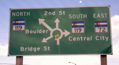
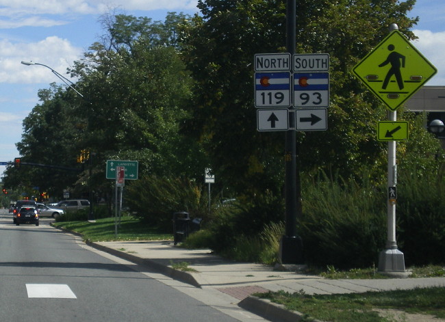
- SH 93 Intersection. Here SH 119 approaches the SH 93 intersection at Broadway in downtown Boulder. September 2008
- Southbound
on SH 119 approaching the split at SH 157 in northeast
Boulder. July 1998
- SH 119/Niwot Road.
Looking southeast on Niwot Road at SH 119. The two
directions of SH 119 are separated by such distance you
can't see the other roadway for SH 119. December 1997
|
|
 |
- SH 125-14 Split, Going to Kremmling or Steamboat?
Then it's the same distance. That's not something you might realize (I
didn't), but from the Muddy Pass intersection, it's the same distance
either direction to Kremmling or Steamboat Springs. September 2007
- Markers for the SH 125-14 Overlap. These markers are at the intersection of SH 125-14 and CR 12W just west of Walden. September 2007
- Northbound in Walden, SH 125-14 Split • Markers • Towns. As SH
125-14 turns onto Main Street on the south side of Walden, it
immediately encounters the SH 14 turnoff at 6th Street. The markers
photo shows the sign at a funky angle because of the curve just south
of the intersection. The photo of the towns sign shows a goofed-up sign
with different letter heights. September 2007
- SH 14 Southbound. The guide sign on southbound SH 125 at the SH 14 intersection at 6th Street. September 2007
- Downtown Walden. It's two blocks long. Northbound on Main Street. September 2007
- Cowdrey. Northbound on SH 125 as it comes in to Cowdrey. September 2007
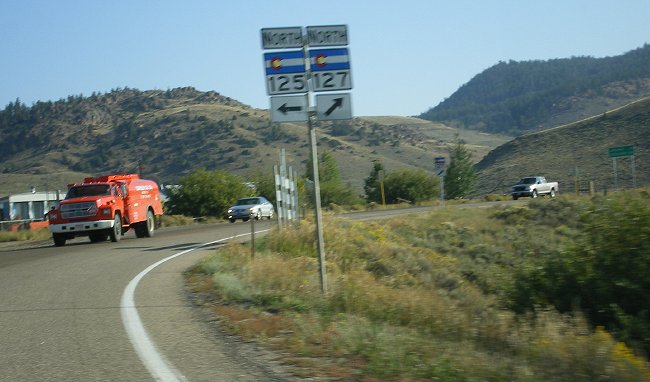
- Northbound at SH 127.
Kinda blurry picture on northbound SH 125 at SH 127. The intersection
features a sharp curve to the right to SH 127 and a left turn to
continue on SH 125. September 2007
- North Platte River Crossing. Northbound SH 125 as it dips down to the North Platte River bridge northwest of SH 127. September 2007
- Wyoming Border, Begin SH 125.
Looking along SH 125 back into Colorado at the Wyoming border. The
marker sign has the "south" but is missing the "125". September 2007
|
|
 |
- SH 125 Approach.
Southbound on SH 127 approaching SH 125. Here they used an oddball
arrangement to mark the turn to northbound SH 125. September 2007
- SH 127 Northound. The view on nortbound SH 127 about five miles from SH 125. September 2007
- SH 127 Wyoming Border.
Here's SH 127 looking back into Colorado from Wyoming. You can see the
pavement change in the foreground that marks the border. Off to the
left there's a Forest Service sign which has "Welcome to Colorful
Colorado" on the top of it, the first time I think I've seen a USFS
national forest sign also marking a state border. The CDOT "Welcome to
Colorful Coloado" sign is a little further down the road. September
2007
|
|
 |
- North Fork Valley. Typical scenery of the North Fork Valley heading northeast near Paonia. August 2009
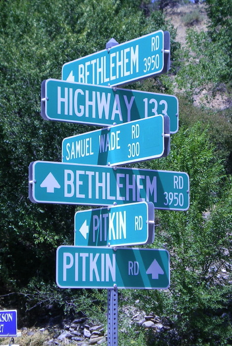
- Navigational Overload.
I'll give Delta County credit: When they installed new street name
signs throughout the county they did a very thorough job. However,
there's such a thing a too much information, as illustrated by this
sign tree at SH 133 and Samual Wade Rd on the west side of Paonia. August 2009
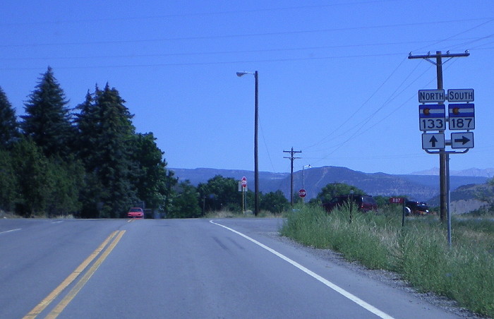
- SH 187 Intersection. Marker assembly on SH 133 as it intersects where SH 187 used to be north of Paonia. August 2009
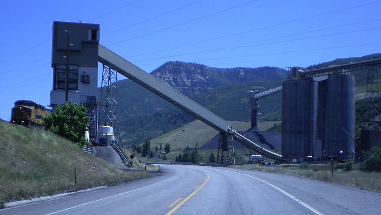
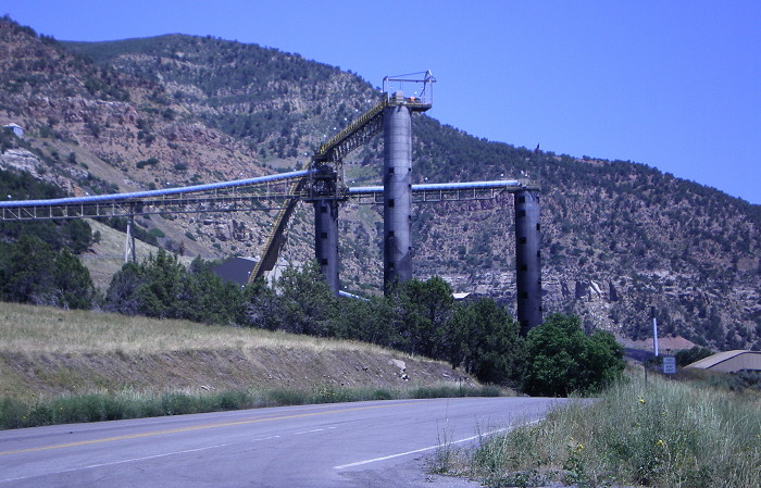
- East Somerset Coal Mine.
Approaching one of the area's coal mines east of Somerset. Ahead is the
conveyor taking coal from the south mountainside over SH 133 to the
tipple house on the north side. On the left a UPRR engine is visible
pulling coal cars through the tipple. August 2009
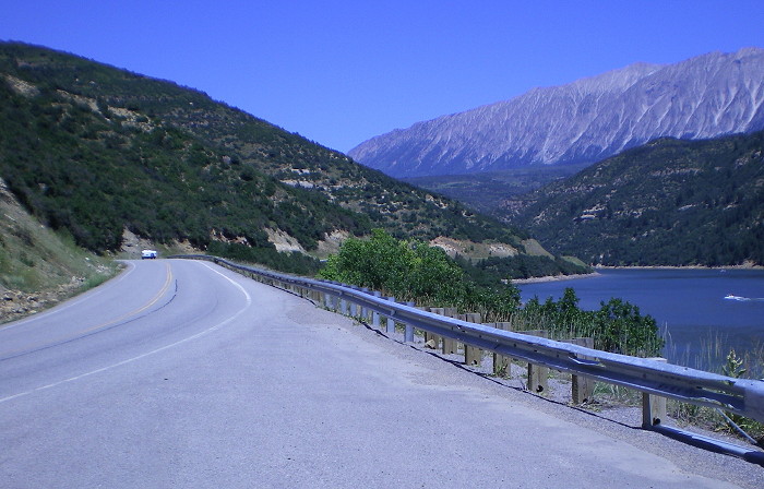
- Paonia Reservoir. Northbound SH 133 along the side of Paonia Reservoir. To the northeast are visible "The Raggeds". August 2009
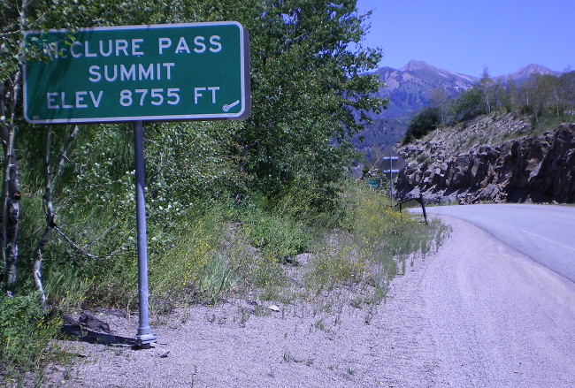
- McClure South Ascent. Northbound SH 133 as it begins its climb up the south side of McClure Pass. August 2009
- McClure Pass Summit. CDOT marker at the SH 133 summit of McClure Pass. August 2009
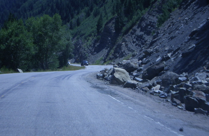
- Rockfall Zone.
The north side of McClure Pass has a rockfall hazard zone, as seen by
all the boulders lining the edge of the road. August 2009
|
|

Bowie Road
|
- Bowie Mine Coal Towers and Overhead Conveyor.
Two pictures of infrastructure of the Bowie coal mine. The first shows
coal towers and conveyors as the coal is brought down from the
mountainside, and the second shows the overhead coveyor crossing Old
133 to get to the rail line. August 2009
- Old 133. Westbound on old 133 east of Bowie. Note it's not in very good shape. August 2009
|
|

|
- US 50 Signal. Signal at SH 135 where it ends at US 50 in Gunnison. August 2009
- Downtown Gunnison. View looking south on SH 135 (Main St) in downtown Gunnison 1 block before it reaches US 50. August 2009
- Northbound SH 135. The scenery in the East River valley north of Almont. August 2009
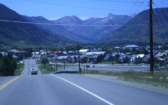
- Entering Crested Butte. Northbound SH 135 as it slows down to enter the east side of Crested Butte. August 2009
|
|
 |
- Douglas Pass South Side. Valley View • Downhill View • Uphill View.
This pullout is just south of the Douglas Pass summit. In the valley
view picture, one can see SH 139 in the center as heads south out the
East Salt Creek valley. The uphill picture shows the summit of the
pass, right at the point where the road curves to the left around the
hill. January 2009
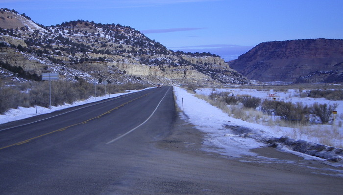
- County Road 27. The view north along SH 139 at Rio Blanco CR 27, near Milepost 55. January 2009
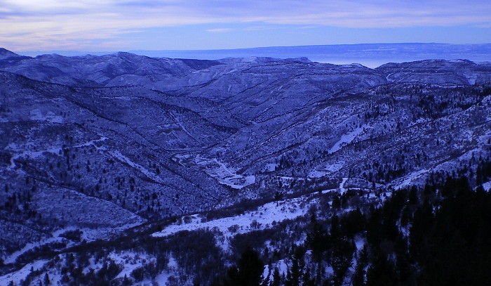
- Douglas Creek Valley. Typical scenery of the Doulgas Creek valley, here on northbound SH 139 at about Milepost 66. January 2009
- SH 64 Intersection Approach Photo 1 • Photo 2. Two pictures on SH 139 as it approaches the SH 64 intersection just outside Rangely. January 2009
|
|

|
- Rio Grande Crossing.
The view on eastbound SH 142 approaching the Rio Grande bridge. Off in
the distance is Culebra Peak, Colorado's southern-most 14er. Photo by
David Herrera. March 2004
|
|

|
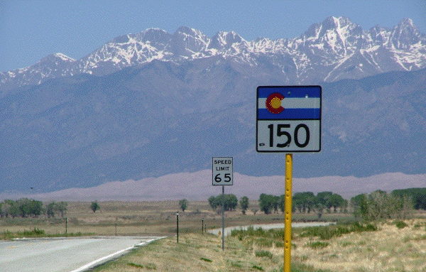
- SH 150, North from US 160. A look at SH 150's beginning, as seen looking north from US 160. Photo by David Herrera. March 2004
- End at US 160. Looking south at the intersection where SH 150 ends at US 160. Photo by Dale Sanderson. May 2008
- Northbound Marker, Sangre de Cristo Mountains. One of SH 150's reassurance markers with the Sangre de Cristo Mountains as a backdrop. Photo by Dale Sanderson. May 2008
- No Snowplowing at Night. Advisory sign about CDOT's policy of not plowing lightly-traveled roads at night. August 2010
- CR 6N Intersection.
Southbound SH 150 at the intersection with CR 6N, where one turns to
get to Mosca and northward toward Poncha Springs. August 2010
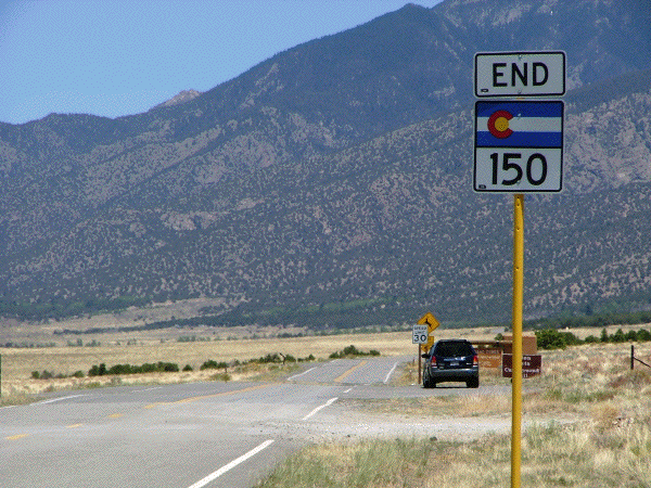
- End SH 150, Park Boundary.
The north end of SH 150 at the Sand Dunes park boundary, with the
signboard and pullout visible ahead. Photo by Dale Sanderson. May 2008
|
|
|
|

|
- Foothills Parkway.
Looking south down Foothills Parkway from the Park East Park
pedestrian overpass. January 1999
|
|
|
|

|
- New Mexico Border.
A good shot of SH 159 as it enters Colorado from New Mexico, showing
the border signing as well as the mountain scenery. Photo by David
Herrera. March 2005
- Blanca Peak
Group. The scenery on SH 159 about one mile north of
the New Mexico border. Visible is the Blanca Peak Group
which includes Little Bear Peak and Mount Lindsey. Photo by
David Herrera. March 2002
- Milepost 30 and Blanca Peak Group.
Another shot of the Blanca Peak Group of the Sangre de Cristo
Mountains, this one facing north on SH 159 at Milepost 30. Photo by
David Herrera. March 2005
|
|
|

|
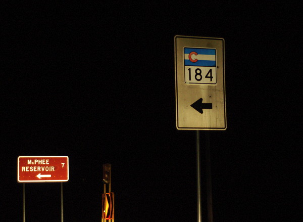
- SH 184 Whiteboard.
Here's a night shot of an old-style whiteboard marker sign on US 491.
Somehow it's managed to survive the past 1980s up to this point. Photo
by Levente Jakab. November 2008
|
|
|

|
DEFUNCT HIGHWAY
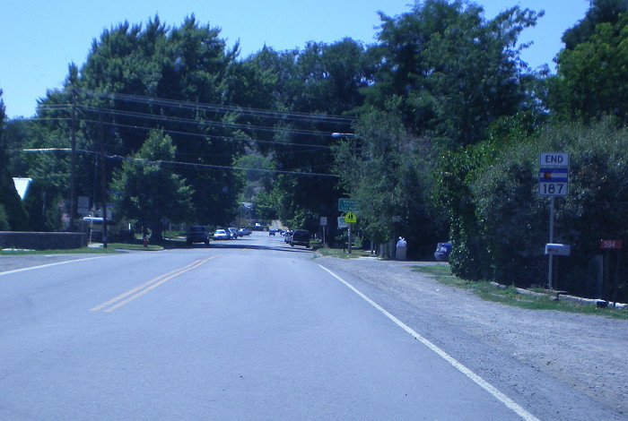
- Southbound SH 187.
View looking down SH 187's entire length from SH 133 across the river
bridge into Paonia. SH 187 was turned back in 2010. August 2009
- End 187. Sign on Grand Ave as SH 187 ends at 4th St. Downtown is another two blocks ahead. SH 187 was turned back in 2010. August 2009
|
|
|
|

|
- I-270 Bridge.
Eastbound on SH 224 at the overpass for I-270. October 1999
|
|
|
|

|
DEFUNCT HIGHWAY
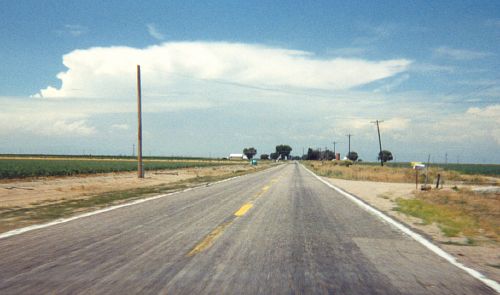
- SH 256. Westbound on SH
256. June 1998
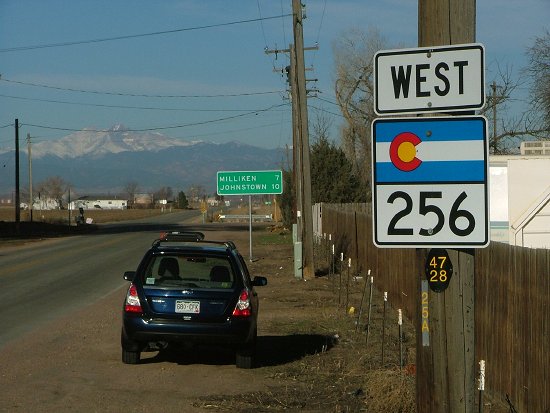
- Westbound from US 85. The view toward the mountains on SH 256 from US 85. Photo by Dale Sanderson. March 2007
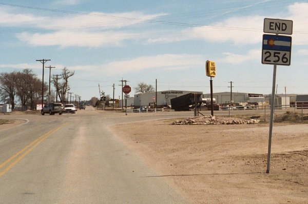
- End at US 85. The "End" sign for eastbound SH 256 approaching US 85. March 2007
|
|
|
|

|
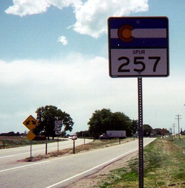
- Spur 257. This sign was new as of Spring 1999, but disappeared when the west end was barricaded.
You can see "SPUR" in very small letters
above the numbers, while "257" is smaller than normal. I
know of no other signs in Colorado like this. On the left
side of the picture you can see an "Either Side" sign,
with westbound BR 34 curving off to the left.
|
|
|

|
PARTLY DEFUNCT HIGHWAY
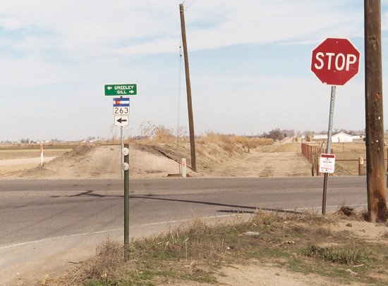
- US 85 Westbound.
Westbound on SH 263 approaching US 85 in Greeley. What's weird is the
sign only points left for US 85 even though it goes both directions.
March 2007
- Closeup of Signal Sign. On the signal in the above photo is this street name sign. It calls US 85 "85 Bypass". 700 is the block number. March 2007
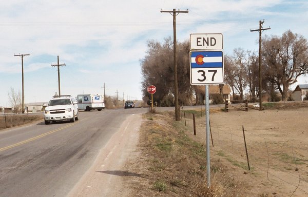
- Former SH 37 Sign. Eastbound at its former end at SH 37, SH 263 had this sign which combined the juntion and arrows onto the same sign. March 2007
|
|
|
|

|
|
|
|

|
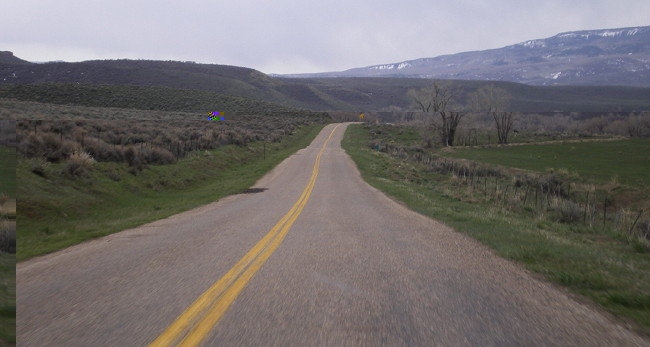
- Eastbound SH 317. This is a state highway? May 2008
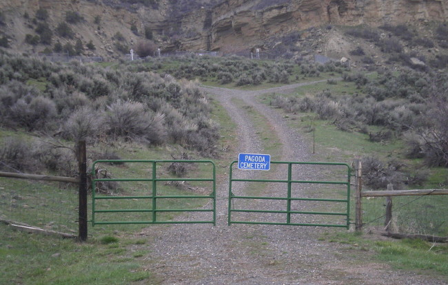
- Pagoda Cemetary. Several hundred feet west of the end of SH 317 is the gate leading to the cemetary. May 2008
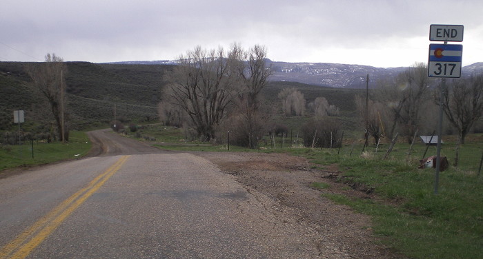
- End SH 317. The road turns to gravel and becomes CR 29. May 2008
|
|

|
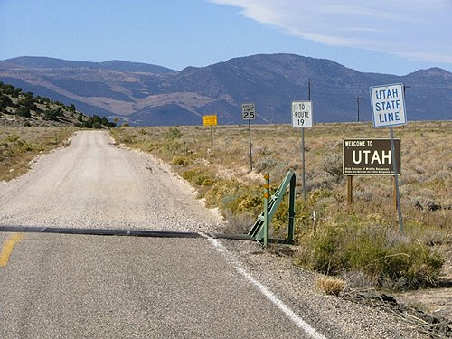
- Utah Border, Westbound.
This picture shows SH 318 as it crosses a cattle guard at the Utah
border and instantly degenerates into a 25mph gravel road. Photo by
Dale Sanderson. October 2005
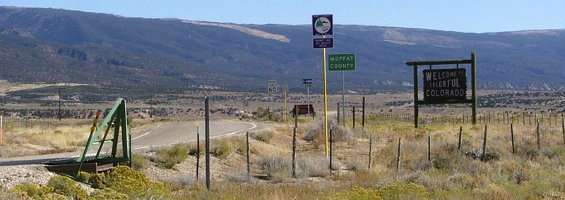
-
Utah Border, Eastbound. This shot shows an overview of start of SH 318 at the Utah border. Photo by Dale Sanderson. October 2005
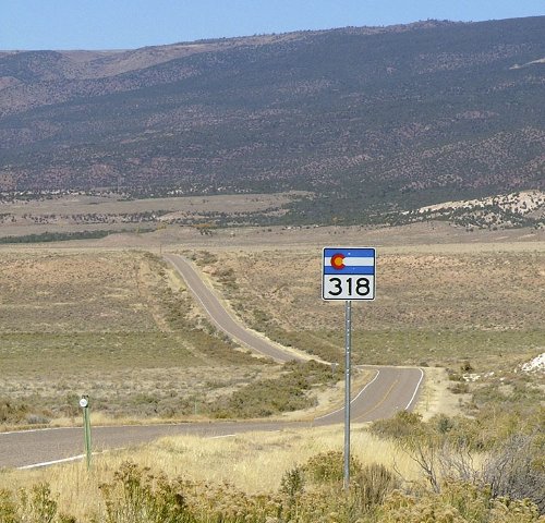
-
Last Westbound Marker.
This is the last westbound SH 318 reassurance marker, about 10 miles
east of the Utah border. In background is Cold Spring Mountain. Photo
by Dale Sanderson. October 2005
|
|
|
|

|
- SH 340/BL 70.
Messed-up signs at SH 340's east end in Grand Junction.
Photo by Robert Halonen.
|
|
|

|
|
|
|

|
- Post-SH 368 Distance Sign.
Distance sign on westbound SH 370 after the SH 368 intersection. CDOT
doesn't often seem to include route markers in distance signs but does
here. August 2010
|
|
|
|

|
- Kipling Parkway.
Looking north on Kipling Parkway (SH 391) north of Jewell
Avenue. November 2001
|
|
|
|

|
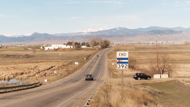
- Westbound from I-25.
The view on westbound SH 392 from I-25. The "end' sign shown was on
borrowed time, as this was only about a month before SH 392 was
extended westward to US 287. March 2007
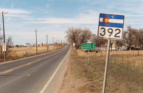
- Westbound from Former SH 37. Signs on westbound SH 392 from the old SH 37 intersection east of Lucerne. March 2007
- Eastbound Approaching Former SH 37. The signs eastbound approaching SH 392's former end at old SH 37. Photo by Dale Sanderson. March 2007
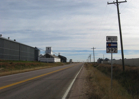
- Briggsdale Reassurance Marker. This is the westbound sign headed south from SH 14 at Briggsdale. Photo by Robert Halonen. October 2008
- SH 14 Text Sign.
When signs for SH 392 finally appeared in Briggsdale, the ones on SH 14
were text style instead of the usual state highway marker. No idea why.
Photo by Robert Halonen. October 2008
|
|
|

|
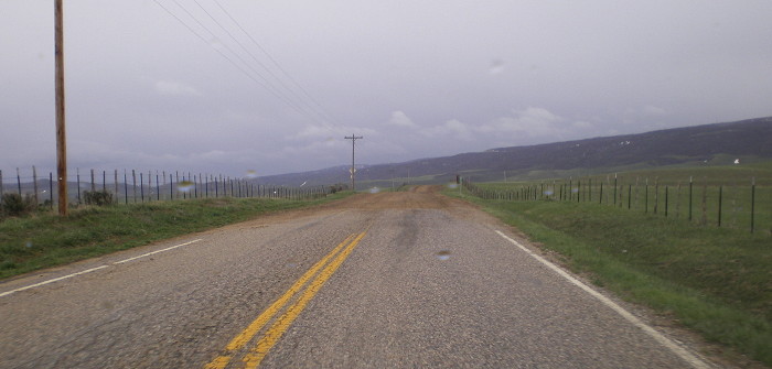
- End of Pavement. The start of the gravel section of SH 394. Ignore the raindrops on the windshield. May 2008
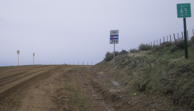
- End SH 394. The county line where SH 394 becomes CR 65. It's unusual to see the county marker before the end sign. May 2008
|
|
|
|

|
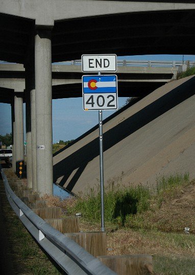
- End SH 402. Good
shot of the END marker on SH 402 at the I-25 underpass.
Photo courtesy Chuck Doolittle.
|
|
|
|

|
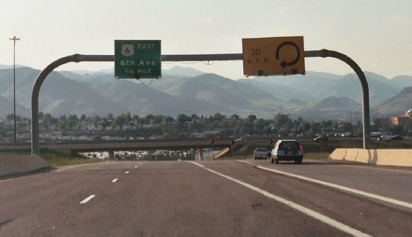
- West or East US 6. The
choice drivers make at the northwest end of SH 470 at Sixth
Avenue/US 6. June 2003
- Loop Advisory
Speed. A unique advisory speed sign on the ramp from
westbound SH 470 to westbound I-70. June 2003
- US 6/I-70 Signs.
Overhead signs as westbound SH 470 is climbing a hill
approaching I-70. June 2003
- Northwest of
Morrison. Westbound SH 470 on its six-lane section
northwest of Morrison. The overpass in the distance is
Alameda Parkway. Off to the right you can see the Centennial
Bike Trail and Rooney Road. June 2003
- Morrison Exit.
Westbound at the two-lane exit for Morrison Road. Photo by
Drew Willsey. July 2003
- Approaching Morrison
Exit. Westbound SH 470 between US 285 and Morrison
Road, with the Soad Lakes area of Bear Creek Park off to the
right side. Photo by Drew Willsey. July 2003
- US 285 Signs.
Overheads signs on westbound SH 470 for US 285 at its
cloverleaf interchange. The overpass is for Quincy Avenue.
June 2003
- Wadsworth Boulevard.
Westbound SH 470 approaching the offramp to Wadsworth
Boulevard/SH 121. June 2003
- West of Quebec.
Westbound SH 470 as it crosses the rolling terrain of
northern Dougals County west of Quebec Street. June 2003
- C-470 at I-25.
Signing on eastbound SH 470 at I-25. June 2001
|