Exit or
Milepost
|
Northbound Exits
Scroll Down
|
Southbound Exits
Scroll Up
|
Notes
|
|
 NORTH
NORTH
|
SOUTH
Raton
|

|
460 NM
0 CO
|
Raton Pass
Elevation 7834 ft
|
|
New Mexico
Colfax County
Colorado
Las Animas County |
0
|

|
|
|
2
|
Wootton
|
Northbound:
 
|
6
|
Gallinas
|
Northbound:
 
|
8
|
Spring Creek
|
Northbound:
|
11
|
Starkville
|
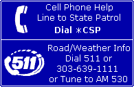
WEIGH STATION
|
|
 
|
|
 
|
|
|
13A
|
Van Buren Street
(Trinidad) |
|
|
13B NB
13 SB
|
 WEST
WEST
Main Street
(Trinidad)
|
 
Colorado Welcome Center
|
Trinidad Lake State Park
 Highway of Legends Highway of Legends
|
13
|
Purgatoire River
|
|
14
|
Commercial Street
Downtown Trinidad |
Trinidad State Junior College
|
|
|
15
|
|
EAST

|
NORTH

| TO

|
|
Goddard Avenue
Kit Carson Trail
(Trinidad)
La Junta
|
|
|
|
 Santa Fe Trail Santa Fe Trail
|
|
 |
|
|
18
|
(CR 32.4)
El Moro Road
|

|
23
|
(CR 42)
Hoehne Road
|
|
27
|
(CR 44)
Ludlow
|
Ludlow Massacre Memorial
|
30
|
(CR 63.1)
Aguilar Road
|
|
34
|
(SPUR  ) )
Aguilar
|
|
39
|
Las Animas County
Huerfano County
|
|
41
|
(CR 240, CR 310.2)
Rugby Road
|
Northbound:
|
42
|
Rouse Road
Pryor
|
|
49
|
|
NORTH
|
TO WEST
|
|
Walsenburg
Alamosa
La Veta
|
|
|
NORTH
|
TO WEST
|
|
(Walsenburg)
Alamosa
|
|
|
Great Sand Dunes National Park & Preserve
Lathrop State Park
TO Highway of Legends |
49
|
Cucharas River
|
|
50
|
|
(WEST
)
|
EAST

|
|
(Walsenburg)
La Junta
|
|
|
|
|
52
|
|
(SOUTH
)
|
NORTH

|
|
Gardner
Westcliffe
|
|
|
SOUTH
|
TO
WEST
| TO
NORTH
|
|
Walsenburg
Alamosa
Gardner
Westcliffe
La Veta
|
|
|
Great Sand Dunes National Park & Preserve
Lathrop State Park
TO Highway of Legends
|
52 to 71
|
HIGH WIND AREA |
|
|
55
|
(CR 101)
Airport Road
|
 Johnson Field Johnson Field
|
56
|
(CR 610)
Red Rock Road
|
TO NORTH
|
59
|
(CR 103)
Butte Road
|
Southbound:
|
59
|
Point of Interest -
Huerfano Butte |
|
|
59
|
Huerfano River
|
|
60
|
Huerfano
|
|
64
|
(CR 110, CR 650)
Lascar Road
|
|
67
|
(CR 660, CR 670)
Apache
|
|
69
|
Huerfano County
Pueblo County
|
|
Exit or
Milepost
|
Northbound Exits
Scroll Down
|
Southbound Exits
Scroll Up
|
Notes
|
| 71 to 52 |
|
HIGH WIND AREA |
|
71
|
Graneros Road
(Thacker Road)
(Colorado City)
|
|
74
|
 WEST
WEST
Colorado City
Rye
San Isabel
|
|
|
Frontier Pathways
|
77
|
(CR 345)
Abbey Road
Hatchet Ranch Road
|
|
83
|
Brantzell
|
|
87
|
(CR 337)
Verde Road
|
Northbound:

|
87
|
Saint Charles River
|
|
88
|
(CR 246)
Burnt Mill Road
|
|
91
|
(CR 308, Lime Road)
Stem Beach
|
Saint Charles Reservoir
|
|
Entering Pueblo
|
|
|
94
|
 |
|
|
94
|
 NORTH NORTH
Pueblo Boulevard
|
Pueblo Zoo
Northbound:
State Fairgrounds
Lake Pueblo State Park
|
95
|
|
Illinois Avenue
|
|
|
  |
|
|
96
|
Indiana Avenue
| Minnequa Avenue
Indiana Avenue
|
|
Southbound:
|
|
  |
|
|
97A
|
Central Avenue
TO Northern Avenue
|
Minnequa Business District
|
97B
|
Abriendo Avenue
|
|
97
|
Arkansas River
|
|
98A
|
BUSINESS
 EAST
EAST
(Santa Fe Avenue)
La Junta
|
Runyon Field
|
|
|
98
|
|
|
|
98B
|
1st Street
TO 
|
1st Street
|
Downtown
Historic Riverwalk
|
|
Frontier Pathways
|
99A
|
|
6th Street
TO
|
Southbound: State Fairgrounds
|
Downtown
|
|
|
99B
|
13th Street
Santa Fe Avenue
|
|
Downtown
|
100A
|
EAST
La Junta
|
|
|
|
|
|
100B
|
29th Street
|
|
101
|
|
WEST
|
EAST

|
(TO EAST
)
|
|
(Pueblo West)
Ca�on City
Royal Gorge
(La Junta)
|
|
Colorado State University - Pueblo
Pueblo Memorial Airport
|
|
Pueblo Mall
Southbound:
Lake Pueblo State Park
|
|
|
|
|
102
|
Eagleridge Boulevard
|
|
|
|
|
|
|
|
Entering Pueblo
|
|
104
|
Eden
(Dillon Drive West, North Elizabeth Street)
(TO Platteville Boulevard, Pueblo West)
|
|
106
|
Porter Draw
|

FRONTAGE ROAD
ACCESS ONLY
NO CROSSOVER
|
108
|
Purcell Boulevard
Pueblo West
|
Formerly Bragdon
|
110
|
Pi�on
|
|
111
|
|
|
|
114
|
Young Hollow
|
|
115
|
|
|
|
116
|
County Line Road
|
|
117
|
Pueblo County
El Paso County
|
|
119
|
Rancho Colorado Boulevard
|
Formerly Midway
|
122
|
Pikes Peak International Raceway |
Northbound:
|
123
|
EXIT 123
|
|
125
|
Ray Nixon Road
|
|
128
|
NORTH
(Santa Fe Drive)
Fountain
|
|
 Fountain Park-n-Ride Fountain Park-n-Ride |
|
NORTH
Colorado Springs
|
SOUTH
|
|
Exit or
Milepost
|
Northbound Exits
Scroll Down
|
Southbound Exits
Scroll Up
|
Notes
|