Colorado Highways: US 24

Return to Routes
20-39
Colo Hwys
Home About

Location: Central Mountains > Southern Front
Range > Eastern Plains
Length: 331mi implied; 274.40mi* signed
W End: Jct I-70/US 6 Exit 171 north of Minturn
E End: Kansas
border with unmarked overlap on I-70 east of Burlington (link to Richie
Kennedy's site)
Nationally: E End: Jct I-75 in Waterford, Michigan
(1540mi)
Counties: Eagle, Lake, Chaffee, Park, Teller, El
Paso, Elbert, Lincoln, Kit Carson
Places: Minturn, Red Cliff, Leadville, Buena Vista,
Hartsel, Florissant, Divide, Woodland Park, Green Mountain
Falls, Manitou Springs, Colorado Springs, Calhan, Ramah,
Simla, Limon, Seibert, Vona, Stratton, Bethune, Burlington
NHS:
- While concurrent with US 285
- SH 67 at Divide east through Colorado Springs to US 40-287/Spur 24 west of Limon
Freeway: While on I-25 from Exits 141 to 139 and
east from I-25 (Exit 139) to Chelton Road (exit
list)
Expressway:
- Five-lane undivided Divide to Woodland Park
- Woodland Park to I-25 (Exit 141)
- In Colorado Springs, from Chelton Road east along Fountain
Blvd., north on Powers Blvd., and northeast to Garrett Rd
Spur Connection:
From US 24 west of Limon northeast to I-70 (Exit 359)
Business Route:
Manitou Springs
Broken Route: Discontinuous due to these unmarked
multiplexes with Interstates:
- I-70 Exit 363 east of Limon to the north
I-70 frontage at CR 12 west of Seibert
- From a point on the north I-70 frontage road near
Exit 438 east of Burlington to the Kansas border
Mountain Passes:
- Tennessee Pass (elevation 10,424ft; 6% grade)
- Trout Creek Pass (elevation 9364ft; 5.2% grade)
- Wilkerson Pass (elevation 9507ft; 5.8% grade)
- Ute Pass (elevation 9165 ft; 5.6% grade)
Roadway Names:
- Expressway through Manitou Springs is the Midland
Expressway
Memorial Designations:
- 10th Mountain Division Memorial Highway, I-70 to
Leadville
- Freeway east of I-25 is the Martin Luther King, Jr.
Memorial Bypass
 Scenic & Historic Byways:
- Top of the Rockies (I-70 to SH 82)

- Collegiate Peaks (SH 82 to US 285)
Milepost Guide:
- 143.40: I-70/US 6 Exit 171 interchange
at Dowd Junction (begin US 24 in Eagle County)
- 165.89: Enter Lake County, Tennessee Pass
- 174.64: SH 91 north of Leadville
- 180.09: SH 300, Malta
- 191.18: SH 82 east of Twin Lakes
- 192.74: Enter Chaffee County
- 212.90: West jct US 285 south of Buena
Vista
- 225.57: Enter Park County, Trout Creek Pass
- 226.55: East jct US 285, Antero
Junction
- 238.23: West jct SH 9, Hartsel
- 239.32: East jct SH 9, Hartsel
- 267.21: Enter Teller County
- 278.09: West jct SH 67, Divide
- 284.82: East jct SH 67, Woodland Park
- 288.46: Enter El Paso County
- 297.08: West jct BR US 24 interchange, Manitou
Springs
- 299.06: Center jct BR US 24 interchange
- 300.43: East jct BR US 24
- 303.84: I-25 Exit 141 interchange,
Colorado Springs
|
- 303.41: I-25 Exit 139 interchange (milepost less than previous due to realignment)
- 308.23: South jct SH 21 at Fountain Blvd/Powers Blvd
- 310.88: North jct SH 21 at Platte Ave/Powers Blvd interchange
- 312.43: SH 94 east of Colorado
Springs
- 350.58: Enter Elbert County
- 376.56: Enter Lincoln County
- 376.75: US 40-287-Spur 24 west of
Limon
- 377.67: West jct SH 71, Limon
- 378.80: East jct SH 71, Limon
- 379.19: I-70 Exit 361 interchange east
of Limon
- 380.46: I-70/US 40-287 Exit 363
interchange east of Limon (end US 24)
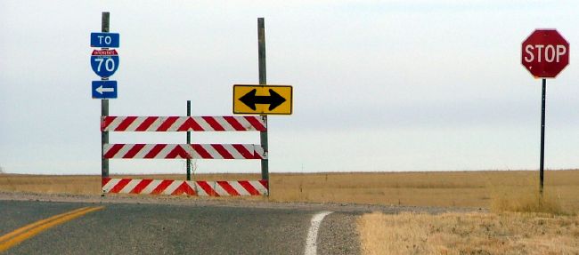
- 419.95: CR 12/north I-70 frontage
road west of Seibert (begin US 24 in Kit Carson County)
- 422.70: SH 59, Seibert
- 429.60: BS I-70, Vona
- 437.20: SH 57, Stratton
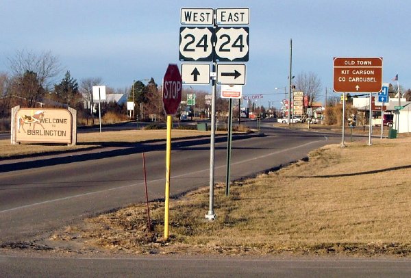
- 454.83: West jct US 385, Burlington
- 455.88: East jct US 385
- 456.02: BL I-70 (to Exit 438) in east
Burlington
- 457.29: On north I-70 frontage road east of
Burlington (end US 24)
|
Annual Average Daily Traffic (2008):
- 7500 at I-70/US 6 Exit 171
- 2500 at Gilman
- 2100 north of Homestake Rd
- 3000 north of SH 91
- 9400 south of Mountain View Dr., Leadville
- 3800 south of SH 300, Malta
- 2700 south of SH 82
- 12,200 south of Main St., Buena Vista
- 5700 on US 24-285, Johnson Village
- 2400 on US 24-285, Trout Creek Pass
- 1400 east of US 285
- 2600 on US 24/SH 9, Hartsel
- 2000 west of CR 77
- 3500 at Lake George
- 15,900 east of SH 67, Divide
- 29,900 east of Maple St., Woodland
Park
- 28,800 southeast of center jct BR 24
- 43,000 northwest of I-25, Colorado
Springs
- 35,800 east of I-25
|
- 29,700 east of Alvarado Dr
- 38,700 on US 24/SH 21 north of Aeroplaza Rd
- 42,300 east of Powers Blvd.
- 17,700 east of SH 94
- 4800 east of Peyton Hwy
- 4900 at Colorado St., Calhan
- 3000 east of Ramah Hwy.
- 2200 east of Matheson
- 3700 on US 24-40-287 east of Spur US 24
- 7100 east of E Ave., Limon
- 2000 between I-70 Exits 361 and 363
- 120 west of Seibert
- 470 east of SH 59, Seibert
- 290 east of BS 70, Vona
- 1200 west of SH 57, Stratton
- 640 east of Stratton
- 780 east of Bethune
- 6000 on US 24-385, Burlington
- 1100 northeast of BL 70
|
Guide:
Starting at I-70 Exit 171 north of Minturn, US 24 heads south via the
Eagle River, through Minturn, the mining ghost town of Gilman, Red
Cliff, over Tennesee Pass, then into Leadville. The trip is
particularly curvy and slow between Minturn and Red Cliff where US 24
has to exit the Eagle River canyon and hug the side of Battle Mountain.
North of Tennessee Pass US 24 passes Camp Hale, the historic site where
the Army's 10th Mountain Division once trained. Tennessee Pass' two
sides have somewhat different characters, with the north side having a
curvy alignment and several switchbacks, but the south side being
fairly straight. Going up Tennessee Pass US 24 crosses many
high-mountain meadows and follows a UPRR railline. On both sides it
isn't too much of a vertical change since the bottom of the pass is
already so high. The top of Tennessee Pass features a 10th Mountain Division Memorial site.
South of Tennessee Pass US 24 picks up the Tennessee Park
valley, then intersects SH 91 and heads south into Leadville. US 24
comes south as Poplar St., turns west on 9th St., south on Harrison
St., west on Washington St., then picks up the Arkansas River at Malta.
US 24 follows the Arkansas south all the way to Buena Vista on a fairly
straight, 65mph alignment. One mile south of downtown Buena Vista US 24
intersects US 285, and turns northeast up 285 northbound.
At Antero
Junction (no town) US 285 and US 24 diverge, with 285 heading north
toward Denver while 24
goes northeast. US 24 then goes through the crossroads town of Hartsel
at SH 9 and takes an almost arrow-straight alignment across the South
Park plain, eventually slowing down to climb up and over Wilkerson
Pass. The summit of the pass features a Forest Service visitors center
which can double as a handy rest stop. After descending the east side
of the pass, US 24 speeds through semi-alpine meadows on a 60mph
alignment. The towns of Lake
George and Florissant are next.
East of Florrisant US 24 climbs up Twin Creek, which as times is a
fairly narrow canyon. At the top is Ute Pass, which falls within
spitting distance of the west side of the SH 67 intersection at Divide.
Only the west side of Ute Pass has any kind of elevation change,
heading east from Divide there is no major elevation fall. Also at SH
67 US 24 turns into a five-lane expressway and rolls over the
terrain to Woodland Park.
US 24 goes right through the congested central part of Woodland Park
on Midland Ave., eventually popping out the east side of town and
becoming a divided expressway (the Midland Expressway). It then heads
southeast toward metro Colorado Springs, using a fairly steep decent
down a canyon for Fountain Creek toward Manitou Springs. Along the way
are Crystola, Green Mountain Falls and Cascade.In Manitou Springs, US 24 has a business
route, and continues southeast on the Midland Expressway
with an interchange in town. From Manitou Springs to I-25,
US 24 has a steady string of signals.
In Colorado Springs, US 24 hits I-25 at Exit 141. There,
one can continue east under I-25 onto Cimarron St. and into
downtown Springs. US 24 goes south on I-25 to Exit 139, then
east via the US 24 bypass (Martin Luther King, Jr. Memorial
Bypass). The bypass is freeway for two miles from I-25, over
Fountain Creek, over railroad tracks, to a signal with
Chelton Road. There are interchanges at Union Blvd. and
Circle Dr. (SH 29). US 24 then picks up Fountain Blvd. and
follows that east. At Powers Blvd. US 24 intersects SH 21 and turns north on
Powers, a four-lane divided facility, then at the Platte Ave.
interchange turns east.
At SH 94, US 24 curves northeast and begins its journey across
the high plains toward Limon. While maps give the impression it's a
very straight alignment, it's actually fairly curvy and constantly
rising and falling with the rolling terrain. The towns of Peyton,
Calhan, Ramah, Simla and Matheson are passed through. Heading westward
from Limon, Pikes Peak is visible before even getting to Matheson.
At Limon, US 24 does some pretty wacky stuff. While maps
show US 24 going out to I-70 Exit 359 on the west side of
town, that is actually defined as a
US 24 spur by CDOT (home-made maps available via the
Spur 24 link). US 24 goes east through Limon on Main St.,
concurrent with BL I-70, US 287, US 40, and for a short
distance, SH 71.
On the east side of Limon, US 24-287-40/BL 70 hits I-70
at Exit 361, and they cross over to I-70's north side. They
go northeast for a short distance, then curve back southeast
to I-70 Exit 363. This road is defined solely as US 24 in
CDOT sources, but carries the three US routes. At Exit 363,
US 40-287 continues southeast, while US 24 ends and has an
unmarked multiplex going east along I-70.
US 24 is non-existant from Exit 363 to west of Seibert. US 24 starts
up again on the north I-70 frontage road at the CR 12 overpass west of
town. It then runs along I-70's north side through Seibert, Stratton,
Vona, and Bethune. The road dips up and down with the terrain and
barely slows down for each town. In Burlington, US 24 runs onto Rose
Avenue and from Lincoln Street to 8th Street it has a short overlap
with US 385. At 6th Street on the east side of town (just a block west
of Exit 438) US 24 turns northeast off of Rose Avenue, while BL I-70
goes out to Exit 438. US 24 then heads northeast up the I-70 frontage
road, with state maintenance ending 1.9mi from the Rose intersection.
There is no attempt made by CDOT to ever return US 24 to I-70, even
though Kansas immediately starts marking the I-70/US 24 overlap at the
border.
Dale Sanderson reports there is a remnant of US 24's
heyday just west of the border, near I-70 milepost 444. On
the north frontage road, which is old US 24, exists a
roadside picnic area, still functioning (as of 2004) with tables and
shade trees.
Photo Gallery:
- US
24 South of Minturn. The scenery looking
southeast along US 24, from a pullout between Gilman and Red Cliff. (June 2002)
- Battle Mountain Ascent.
A shot looking along westbound US 24 just on the north side of Red
Cliff. US 24 begins climbing the side of Battle Mountain higher up the
side of the Eagle River canyon, summitting at Gilman and then dropping
down to Minturn. (September 2009)
- Red Cliff Arch (Eagle
River) Bridge. One of my favorite pictures, US
24's Red Cliff Arch Bridge. The road below the bridge that
goes down the canyon with the railroad goes a short
distance to Red Cliff. The plaque on the bridge dates it
to 1940. (June 2002)
- Pando Bridge.
Built in 1941, this bridge takes US 24 over the UPRR at the former
Pando rail siding. Pando was located at the north end of Camp Hale and
was the railroad service point for the camp. (September 2009)
- Top of Tennessee Pass: Westbound • Old Marker • Newer Marker.
The top of Tennessee Pass features a parking area and a memorial to the
10th Mountain Division with a granite slab with the names of soldiers
killed in Europe and the Alaska Kiska campaign during WWII. The old
marker dates from 1929 and features the US shield-shaped symbol for the
Bureau of Public Roads. (September 2009)
- Downtown Leadville. A shot of US 24 as it travels down northbound Harrison Avenue in historic downtown Leadville. (October 2004)
- Cutout-Style
Marker. An unusual (for Colorado) cutout-style US
24 marker south of Leadville. The pole is a newer-style
yellow tube pole, which means either the marker is
relatively new or was reset from a different pole. Photo
courtesy Robert Halonen.
- California Gulch, South of Leadville, Looking West and Looking East.
US 24 uses California Gulch southwest of Leadville, downstream heading
west. But the directions are reversed, with eastbound US 24 going west
down the gulch and westbound US 24 going east up the gulch. Looking
west you see Mount Massive of the Sawatch Range and the Continental
Divide. Looking east is the Mosquito Range. Awfully flat here for being in the middle of the mountains. (September 2006)
- Kobe Valley.
Located about 5 miles north of SH 82, Kobe is a UPRR rail siding along
the east side of US 24 as it heads through a broad Arkansas River
valley. This view on westbound US 24 looks north toward a rainstorm
that was probably near Turquiose Lake. (September 2009)
- North of Buena Vista. A view of westbound US 24 as it goes through the Arkansas River canyon north of Buena Vista. (October 2004)
- US 24-285 Split Signs South of Buena Vista, Sign 1 and Sign 2.
These two shots show the signs on westbound US 24-285 approaching the
split south of Buena Vista. The first sign is a little ways before the
intersection, while the second one is nearer to it, and you can see the
T-intersection itself. Both photos by Dale Sanderson. (March 2008)
- Mount Princeton.
The peak dominates the western horizon in this area, as seen on
westbound US 24-285 a little east of Johnson Village. Photo by Dale
Sanderson. (March 2008)
- Curves Sharpen. A specific warning sign on westbound US 24-285 as it enters the Trout Creek canyon east of Johnson Village. (August 2009)
- East of Hartsel. The view on eastbound US 24 as it crosses the broad South Park plain between Hartsel and Wilkerson Pass. (May 2013)
- Wilkerson Pass Sign. Marker sign for Wilkerson Pass as seen from the USFS Visitors Center parking lot. (May 2013)
- East of Wilkerson Pass. Here east of Wilkerson Pass this section of eastbound US 24 features an alpine plain dotted with evergreens. (September 2010)
- East of Divide. As seen on eastbound US 24, it has a five-lane undivded section. (May 2013)
- Woodland Park SH 67 Intersection. The eastbound US 24/SH 67 split features this large destination sign. (September 2010)
- Fountain Creek Canyon.
US 24 eastbound descending down Fountain Creek Canyon west of Manitou
Springs. In some places the two roads are on opposite sides of the
creek. (June 2005)
- Manitou
Springs Business Route Split. Eastbound US 24 at
the west end of the Manitou Springs business route. This
is a mini interchange. (February 2001)
- Powers Blvd Left Turn. Signage on eastbound Fountain Blvd as US 24 approaches its left turn at Powers Blvd/SH 21. (September 2012)
- Powers
Boulevard. Heading north on the Powers Boulevard
section of US 24 in Colorado Springs south of Airport
Road. (September 2003)
- Platte/Powers
Interchange. Eastbound on US 24 (northbound
Powers Boulevard) approaching the interchange at Platte
Avenue. US 24 exits to head east to Limon. Photo by
Russell Kroll. (May 2003)
- Platte Exits to Powers.
Westbound on US 24/Platte Ave. coming up to the Powers Blvd.
interchange. Note WB US 24 is signed going onto SB Powers, and the
signs have empty space set aside for other markers (SH 21, for when Powers is numbered that). (May 2004)
- Peterson
AFB/SH 94. Overhead sign assembly on eastbound US
24 west of SH 94 at Peterson Air Force Base. (September
2003)
- Black Squirrel Creek Truss Bridge.
Westbound on US 24 at an old steel truss bridge over Black Squirrel
Creek at milepost 327 west of Peyton. They don't build bridges like
this anymore. (May 2004)
- Ellicott Highway. The scenery westbound on US 24 near Ellicott Highway, east of Peyton. (May 2004)
- West
Limon Intersection, Eastbound. At the US 24/Spur
24 intersection in west Limon, on eastbound US 24. Note
how I-70 and BL I-70 get the major treatment on the large
sign while US 24, 40 & 287 are on smaller stand-alone
signs up near the intersection. Photo by Dale Sanderson.
(December 2003)
- West
Limon Intersection, Westbound. Same intersection,
but on westbound US 24. Photo by Dale Sanderson.
(December 2003)
- Limon
Multiplex: Older Markers • Newer Markers. Eastbound
Main St. in central Limon. Five, count 'em, five shields through
downtown. This is actually a "wrong-way" multiplex, because it is East
BL 70, 24, and 40, South 287, and North 71. However, note in the second
picture that CDOT cheats and by omitting the direction for SH 71 doesn't
actually mark it as a wrong-way multiplex. First photo courtesy Robert
Halonen (1998), second photo by me (April 2005).
- End West of
Seibert. Westbound US 24 at CR 12 west of
Seibert. To the left of the picture CR 12 has an overpass
over I-70; no interchange, just a grade separation. This
point marks the west end of state maintenance of the
Seibert-Burlington section of US 24. Photo by Dale
Sanderson. (December 2003)
- Jct SH 59,
Seibert. Westbound US 24 approaching SH 59 in
Seibert. Photo by Dale Sanderson. (December 2003)
- Spring Creek Crossing, East of Vona.
One of the dips US 24 makes down to a creek crossing on the Plains,
here on westbound US 24 at Spring Creek. In the distance is Vona. (May
2006)
- East
Burlington. Westbound on BL I-70 at its junction
with US 24 on the east side of Burlington. Photo by Dale
Sanderson. (December 2003)
History:
US 24 in Kansas and Colorado was originally part of a US
40 N/S split. In 1936, the N/S split was eliminated,
with US 24 taking over US 40N east of Limon, and
taking over US 40S from Limon to US 50 in Grand
Junction. In 1937, US 6 was run from Denver all the way to
Grand Junction and beyond, causing US 24 to end up having a
useless multiplex with US 6 from where they intersected out
to Grand Junction.
In Colorado Springs, US 24 at first used Colorado Avenue,
Cascade Street & Platte Avenue heading east. All of US
24 was paved by 1939. In 1961 an expressway was completed
along Platte Avenue east to SH 94. By 1964 west of I-25 the
Midland Expressway was completed west to 31st Street. Also
in 1960s I-70 started to replace US 24 in places west of
Minturn and east of Limon. By 1968 the Midland Expressway
was completed from Cascade to west of Manitou Springs. By
1976 the expressway was complete from Cascade to I-25, and
the buisness route was present in Manitou Springs, and an
interchange was put in at Academy Blvd. The expressway
reached Woodland Park by 1977.
The
US 6-24 multiplex to Grand Junction existed, at least on maps, up to
1976. But as I-70 started to be built in the 1960s and '70s, US 24
slowly disappeared. According to Karl Williamson, as new sections of
I-70 opened the new exit signs would list only US 6 as the frontage
road, even though once on the frontage road the highway carried both US
6 and US 24 markers. Also, US 6-24 served as temporary I-70 between
each built section. When it went all the way to Grand Junction, US 24
had a length of 466mi in Colorado.
Inside of Colorado Springs, US 24 came east into town on
Colorado Ave., then to Cascade Ave., and to Platte Ave up
until 1965. Then it used Cimmaron Street east to Wasatch
then north to Platte and east out of town. The MLK Jr.
Bypass east of I-25 Exit 139 was opened in 1995. Before US
24 used Powers to go north from Fountain Blvd. to Platte
Ave. it at one time used Academy Blvd. (SH 83), because as
of August 2000 there were signs hinting to that.
Related Site: US
24 Endpoints by Dale Sanderson
Continue:
Page created 30 May 2005
Last updated 9 March 2014